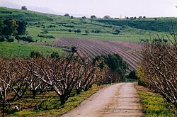
Mewo'ot HaChermon
| Mewo'ot HaChermon | ||
|---|---|---|

|
||
| Basic data | ||
| hebrew : | מועצה אזורית מבואות החרמון | |
| State : |
|
|
| Founded : | 1981 | |
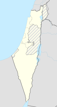
| Coordinates : | 33 ° 7 ' N , 35 ° 34' E | |
| Area : | 134.74 km² | |
| Residents : | 6,800 (2014) | |
| Population density : | 50 inhabitants per km² | |
| Time zone : | UTC + 2 | |
| Community type: | Regional administration | |
| Website : | ||
|
|
||
Mewo'ot HaChermon Regional Administration ( Hebrew מועצה אזורית מבואות החרמון) is a regional administration and is located north of the Sea of Galilee on the border with Lebanon in the northern district of Israel . The administrative area was founded in 1981 and is 34.74 km² in size.
Demographics
6800 people live in Mewo'ot HaChermon (as of 2014).
| year | 1983 | 1995 | 2006 | 2008 | 2009 | 2010 | 2011 | 2012 | 2013 | 2014 |
|---|---|---|---|---|---|---|---|---|---|---|
| Residents | 2,300 | 4,000 | 6,000 | 6,100 | 6,200 | 6,300 | 6,400 | 6,600 | 6,700 | 6,800 |
swell
- Statistical Abstract of Israel 2015 - No. 66 Subject 2 - Table No. 22. Retrieved August 17, 2018
- מועצה אזורית מבואות החרמון | איכות חיים אחרת בין חרמון לכנרת (homepage from mvhr.org.il), accessed on August 17, 2018
