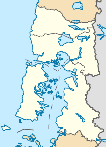
Michinmahuida
| Michinmahuida | ||
|---|---|---|
| height | 2404 m | |
| location | Región de los Lagos ( Region X), Chile | |
| Mountains | To the | |
| Coordinates | 42 ° 48 '2 " S , 72 ° 26' 47" W | |
|
|
||
| Last eruption | 1835 | |
The Michinmahuida is a heavily glaciated stratovolcano in the Región de los Lagos in Chile . The volcano lies on the Liquiñe Ofqui fault zone . In 2008 the glacier was covered by the ashes of the Chaitén volcano, which erupted around 15 km to the southwest . A south-flowing glacier tongue reaches an altitude of almost 600 meters (as of 2014). The volcano is located in the southern part of Pumalín Park , a private sanctuary owned by US millionaire Douglas Tompkins . The next larger settlement is Chaitén .
Individual evidence
- ↑ Earth Observatory , accessed February 18, 2015

