Chaitén
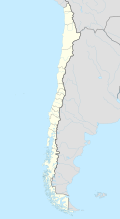
Chaitén is a city in the south of the South American Andean state of Chile . It is located in the Región de los Lagos (Region X). Chaitén had around 5000 inhabitants (2017) and is the capital of the province of Palena .
geography
The city is located on the Gulf of Corcovado , around 100 km east of Chiloé , the second largest island in Chile, and 200 km south of Puerto Montt . The famous Carretera Austral road runs through the city .
In the vicinity of Chaitén there are various volcanoes, northeast of the Michinmahuida , south of the Corcovado and in the immediate vicinity of the Chaitén . On May 2, 2008, the Chaitén volcano erupted and threatened the place of the same name, which was subsequently evacuated.
history
On November 4, 1885, the area around Chaitén was first registered under land law. In 1933 Chaitén consisted of only around 30 wooden houses. It wasn't until a ferry service was established in 1938 that the city began to grow. With the Carretera Austral the real upswing of the city began.
2008 volcanic eruption

As a result of the eruption of the neighboring volcano of the same name , large parts of the city were inundated by a lahar on May 12, 2008 . The river Rio Blanco flowing through the city then paved a new bed, which caused further destruction. In view of the destruction and ongoing volcanic activity, the government decided in 2009 to give up the city and build a new Chaitén on the coast 10 km further north. In the meantime, however, Chaitén has been partially rebuilt in its original location. Around 700 residents have returned so far. The infrastructure is working again, there are hotels, restaurants and shops, a temporary "health station" and, since December 2011, a bank branch again.
economy
Chaitén is a small port town with a small airport. It lives mainly from tourism, fishing and through traffic on the Carretera Austral.
tourism
Visitors can take a ferry from Chaitén to the island of Chiloé and its port cities Castro and Quellón .
About 60 km north of the city is the Parque Pumalin nature park with its 2700 km² and its huge forest areas. The park can be reached in summer by ferry from Hornopirén to Caleta Gonzalo. Caleta Gonzalo can be reached by road from Chaitén. This road was closed after 2008 due to the eruption of the Chaitén volcano, but it is now open again without any problems. A provisional aerodrome for small aircraft is in operation in St. Barbara 10 km north of Chaitén. In summer there are daily flights to and from Puerto Montt.
To the east of Chaitén lies the Michinmahuida volcano with a height of 2404 m. The Termas El Amarillo thermal springs are located southeast of the city .
See also
swell
- ^ Swiss television, May 2, 2008
- ^ Wiener Zeitung May 4, 2008
- ↑ Report to La Tercera (span.) ( Memento of the original of July 13, 2011 in the Internet Archive ) Info: The archive link was automatically inserted and not yet checked. Please check the original and archive link according to the instructions and then remove this notice.
Web links
- Official website of the city (Spanish)
- Report on the Carretera Austral (German)
Coordinates: 42 ° 55 ′ S , 72 ° 43 ′ W


