Mittelmöhnetal
| Mittelmöhnetal | |||
|---|---|---|---|
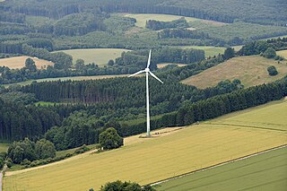
| View of the Mittelmöhnetal between Rüthen and Warstein - Belecke . | |||
| Systematics according to | Handbook of the natural spatial structure of Germany | ||
| Greater region 1st order | Low mountain range threshold | ||
| Greater region 2nd order | Rhenish Slate Mountains | ||
| Main unit group | 33 → Süderbergland |
||
| About main unit | 334 → North Sauerland Oberland |
||
| 4th order region (main unit) |
334.3 → Upper Arnsberg Forest |
||
| Natural space |
334.30 → Mittelmöhnetal |
||
| Geographical location | |||
| Coordinates | 51 ° 29 '6 " N , 8 ° 21' 28" E | ||
|
|||
| local community | Ruethen , Warstein | ||
| state | North Rhine-Westphalia | ||
| Country | Germany | ||
The Mittelmöhnetal , also called Belecker Möhnetal , is a small-scale natural sub-unit with the order number 334.30 of the Upper Arnsberg Forest ("Buchwald") (334.3) within the North Sauerland Oberland (334). According to the handbook of the natural spatial structure of Germany, it comprises the around 50 m deep floodplain valley of the middle Möhne between the Rüthen district Möhnetal and the Warsteiner district Allagen . The Warsteiner district Belecke is located in the middle of the natural area.
The valley lies on the northern edge of the Rhenish Slate Mountains at the transition to the Haarhöhe (542.30) in the Hellwegbörden (542). It is cut into the clay and greywacke slate of the Arnsberg strata and drains a large part of the North Sauerland Oberland. The hull of the slate mountains is covered in a discordant manner north of the valley by flat-lying sediments from the Cretaceous period . The transition has a small step in the terrain , which is moderately sloped and where the Rüthener green sandstone comes to light in some places . This is of Plänerkalken and -mergeln hair height superposed on which the field corridors of the valley communities have been created.

