Miura Peninsula
| Miura Peninsula | ||
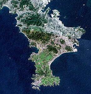
 SRTM image of the peninsula |
||
| Geographical location | ||
|
|
||
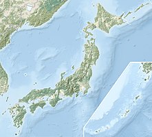
| Coordinates | 35 ° 14 ′ 0 ″ N , 139 ° 40 ′ 0 ″ E | |
| Waters 1 | Tokyo Bay , Pacific Ocean | |
| Waters 2 | Sagami Bay | |
The Miura Peninsula ( Japanese 三浦 半島 Miura-hantō ) is a peninsula in Kanagawa Prefecture in Japan .
It is located south of Yokohama and Tokyo and separates Tokyo Bay in the east from Sagami Bay in the west. The towns and cities on the peninsula include Yokosuka , Miura , Hayama , Zushi, and Kamakura .
The English navigator William Adams , who was raised to the samurai status , who was also called Miura Anjin (Navigator of Miura), received a fiefdom on the peninsula.
In Nihonshoki from the eighth century the spelling is found for the district Miura 御浦[郡] venerable Bay ', instead of later in the importance 三浦 , three bays'.
Web links
Commons : Miura Peninsula - Collection of Images, Videos, and Audio Files
- Tourist guide (english)
