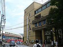
Zushi
| Zushi-shi 逗 子 市 |
||
|---|---|---|
| Geographical location in Japan | ||
|
|
||
| Region : | Kanto | |
| Prefecture : | Kanagawa | |
| Coordinates : | 35 ° 18 ' N , 139 ° 35' E | |
| Basic data | ||
| Surface: | 17.34 km² | |
| Residents : | 56,936 (October 1, 2019) |
|
| Population density : | 3284 inhabitants per km² | |
| Community key : | 14208-5 | |
| Symbols | ||
| Flag / coat of arms: | ||
| Tree : | camellia | |
| Bird : | Gackel Cuckoo | |
| town hall | ||
| Address : |
Zushi City Hall 5 - 2 - 16 , Zushi Zushi -shi Kanagawa 249-8686 |
|
| Website URL: | http://www.city.zushi.kanagawa.jp | |
| Location of Zushi's in Kanagawa Prefecture | ||
Zushi ( Japanese 逗 子 市 , - shi ) is a city in the southeast of Kanagawa Prefecture . Zushi is located south of Tokyo on the Miura Peninsula on Sagami Bay . Zushi was named a city on April 15, 1954.
Zushi is known for the fact that the Tokyo elite have second homes here. The best known is the governor of Tokyo Prefecture Shintaro Ishihara .
In Zushi, many US military personnel live in Ikego . Ikego used to be an ammunition magazine for the Imperial Navy . It extends over 2.8 km² of which 0.8 km² are used as living areas. Ikego was opened in April 1996 and consists of 854 residential wings with around 3400 families. It is located 12 km from the Yokosuka Naval Base .
traffic
- rail
Zushi has two major train stations. The Yokosuka Line stops at Zushi Station in the center and the Keikyu-Zushi Line stops at Zushi New Station in the south .
- Street
sons and daughters of the town
- Gotō Shuichi (1888–1960), archaeologist
- Nobuteru Ishihara (* 1957), politician


