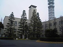
Fujisawa (Kanagawa)
| Fujisawa-shi 藤 沢 市 |
||
|---|---|---|
| Geographical location in Japan | ||
|
|
||
| Region : | Kanto | |
| Prefecture : | Kanagawa | |
| Coordinates : | 35 ° 20 ′ N , 139 ° 29 ′ E | |
| Basic data | ||
| Surface: | 69.51 km² | |
| Residents : | 434,568 (October 1, 2019) |
|
| Population density : | 6252 inhabitants per km² | |
| Community key : | 14205-1 | |
| Symbols | ||
| Flag / coat of arms: | ||
| Tree : | Japanese black pine | |
| Flower : | Wisteria | |
| Bird : | kingfisher | |
| town hall | ||
| Address : |
Fujisawa City Hall 1 - 1 , Asahi-chō Fujisawa -shi Kanagawa 251-8601 |
|
| Website URL: | http://www.city.fujisawa.kanagawa.jp/ | |
| Location of Fujisawa in Kanagawa Prefecture | ||
Fujisawa ( Japanese 藤 沢 市 , - shi ) is a city in the south of Kanagawa Prefecture .
geography
Fujisawa is south of Tokyo , Yokohama and Yamato , west of Kamakura and east of Chigasaki on Sagami Bay . The northern part of the city is on the Sagamino Plateau and the southern part on the Shōnan coastline.
history
Fujisawa was first mentioned in Taiheiki in the late 14th century. Fujisawa developed around the Yugyo-ji Temple, built in 1325 . During the Edo period , Fujisawa was a post office ( 宿 場 町 Shukuba-machi ) of the Tōkaidō on the border of the ancient circles (- gun ) Kōza and Kamakura of the Sagami province .
After the Meiji Restoration , Fujisawa became part of Kanagawa in 1871, as did the entire Sagami Province later. In the western part of Fujisawa, when the districts were reactivated in 1878, the district administration of Kōza was set up as a subdivision of all prefectures, the eastern part continued to belong to the Kamakura district with the administrative seat in Totsuka, the neighboring post office on the Tōkaidō, today part of the city of Yokohama. Edward S. Morse began biological studies on Enoshima Island in 1877 . Fujisawa Station on the Tōkaidō Main Line was inaugurated in 1887.
When the municipality level was modernized in 1889, the western part of Fujisawa became the city (- machi ) Fujisawa-Ōsaka ( 藤 沢 大 坂 町 , -machi ), the eastern parts in Kamakura County became the city Fujisawa-Ōtomi ( 藤 沢 大 富 町 , -machi ) summarized. On October 1, 1907 Fujisawa-Ōtomi was incorporated into Fujisawa-Ōsaka, and from 1908 the city was only called after the incorporation of the two Mura Kugenuma ( 鵠 沼 村 , -mura ) and Meiji ( 明治 村 , -mura ) in Kōza-gun Fujisawa. On October 1, 1940, Fujisawa was named an independent city (- shi ) .
On June 1, 1941, the Mura Muraoka ( 村 岡村 , -mura ), on March 10, 1942, the Mura Mutsuai ( 六 会 村 , -mura ), on April 1, 1947, the Machi Katase ( 片 瀬 町 , -machi ) and On April 5, 1955, the district of Endō ( 遠藤 ) of the Mura Koide ( 小 出 村 , -mura ), the districts of Chōgo ( 長 後 ) and Takakura ( 高 倉 ) of the Machi Shibuya ( 渋 谷 町 , -machi ) and the Mura Goshomi ( 御所見 村 , -mura ) incorporated.
Attractions
- Enoshima
- Shirahata Shrine : The deities of this Shinto shrine are Samukawahiko-no-Mikoto and Minamoto no Yoshitsune . There are two portable shrines ( Mikoshi ), one each for Yoshitsune and Musashibō Benkei . Both were famous people of the Kamakura period , also mentioned in Ruth Benedict's study Chrysanthemum and Sword .
- Ryūkō-ji
traffic
- Street:
- Train:
- JR Tōkaidō Main Line , Fujisawa Station and Tsujidō Station to Tokyo and Kobe, respectively
- Odakyū Enoshima Line to Shinjuku
- Sōtetsu Izumino Line to Yokohama
- Enoshima Dentetsu Line to Kamakura
- Yokohama Subway Line 1 to Azamino
- Shōnan Monorail to Ōfuna
sons and daughters of the town
- Yūichirō Edamoto (* 1988), football player
- Rika Fujiwara (* 1981), tennis player
- Kōki Fukui (born 1995), football player
- Akito Fukumori (* 1992), football player
- Hirokazu Ishihara (* 1999), football player
- Masahiko Kageyama (* 1963), racing car driver
- Masami Kageyama (* 1967), racing car driver
- Masahiro Nakai (* 1972), singer and actor
- Mitsuki Saitō (* 1999), football player
- Gō Soeda (* 1984), tennis player
- Shun Takagi (* 1989), soccer player
- Masao Tsuji (* 1987), soccer player
Twin cities
-
 Miami Beach , USA , since 1959
 -
 Matsumoto , Japan, since 1961
 -
 Windsor , Canada , since 1987
 -
 Boryeong , South Korea , since 2002
Neighboring cities and communities
City friendship
-
 Kunming People's Republic of China , since 1981
Web links
Individual evidence
- ↑ List of parishes in Kōza County since 1889 (Japanese)
- ↑ Fujisawa-shi, municipal information sheet kōhō Fujisawa ( 広 報 ふ じ さ わ ) No. 1628 of March 25, 2018: On the 110th birthday of Fujisawa-machi ( 藤澤 町 誕生 110 年 ) (Japanese)


