Ebina
| Ebina-shi 海 老 名 市 |
||
|---|---|---|
| Geographical location in Japan | ||
|
|
||
| Region : | Kanto | |
| Prefecture : | Kanagawa | |
| Coordinates : | 35 ° 27 ' N , 139 ° 23' E | |
| Basic data | ||
| Surface: | 26.48 km² | |
| Residents : | 133,706 (October 1, 2019) |
|
| Population density : | 5049 inhabitants per km² | |
| Community key : | 14215-8 | |
| Symbols | ||
| Flag / coat of arms: | ||
| Tree : | Buxus microphylla var. Japonica | |
| Flower : | Rhododendron indicum | |
| Bird : | Chinese greenling | |
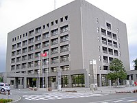
| town hall | ||
| Address : |
Ebina City Hall 175 - 1 , Katsuse Ebina -shi Kanagawa 243-0492 |
|
| Website URL: | http://www.city.ebina.kanagawa.jp/ | |
| Location Ebinas in Kanagawa Prefecture | ||
Ebina ( Japanese 海 老 名 市 , - shi ) is a city in the center of Kanagawa Prefecture . The city received city rights on November 1, 1971.
geography
Ebina is south of Tokyo and Zama , west of Yokohama , Ayase and Yamato , north of Samukawa and east of Atsugi .
The Sagami flows through the city from north to south.
history
The first evidence of settlement dates from over 30,000 years ago. The Sagami Kokubunji Temple was built during the Nara period by order of Emperor Shōmu and allowed the area to flourish. In 1898 the villages of Ebina and Arima were founded, which merged in 1955 and merged into the town of Ebina in 1971.
traffic
Ebina can be reached via the Tōmei Highway , the Ken-Autobahn Highway and the Shin-Tōmei Highway . The Ebina Station is a major transport hub. The Odakyū Odawara Line from Odakyū Dentetsu , the Sagami Line from JR East and the Sōtetsu Main Line from Sagami Tetsudō operate here . The first two lines also run through Atsugi station .
Town twinning
sons and daughters of the town
- Naoko Kijimuta (* 1972), tennis player
- Akiko Kijimuta (* 1968), tennis player


