Yamato (Kanagawa)
| Yamato-shi 大 和 市 |
||
|---|---|---|
|
|
||
| Geographical location in Japan | ||
| Region : | Kanto | |
| Prefecture : | Kanagawa | |
| Coordinates : | 35 ° 29 ' N , 139 ° 27' E | |
| Basic data | ||
| Surface: | 27.06 km² | |
| Residents : | 237,445 (October 1, 2019) |
|
| Population density : | 8775 inhabitants per km² | |
| Community key : | 14213-1 | |
| Symbols | ||
| Flag / coat of arms: | ||
| Tree : | Prunus jamasakura | |
| Flower : | "Wild Chrysanthemum " | |
| Bird : | Blue magpie | |
| town hall | ||
| Address : |
Yamato City Hall 1 - 1 - 1 , Shimotsuruma Yamato -shi Kanagawa 242-8601 |
|
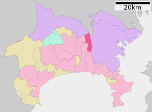
| Location Yamatos in Kanagawa Prefecture | ||
Yamato ( Japanese 大 和 市 , -shi ) is a city in the center of Kanagawa Prefecture .
The Naval Air Facility Atsugi is located on the southwestern city limits of Yamato and Ayase, a base of the United States Navy , which has also been used by the maritime self-defense forces since the 1970s.
geography
The city is south of Tokyo and Sagamihara , west of Yokohama , east of Ebina and Ayase, and north of Fujisawa .
traffic
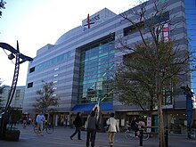
Yamato is accessed by National Road 16 , which circles Tokyo in a wide arc. There are also national roads 246 and 467. An important rail link in the north-south direction is the Odakyū Enoshima Line from Sagami-Ōno via Fujisawa to Katase-Enoshima . At Chūō-Rinkan station you can change to the Tōkyū Den'entoshi line , at Yamato station to the Sōtetsu main line .
Neighboring cities and communities
Town twinning
-
 Minami-Uonuma , Japan
 -
 Taiwa , Japan
 -
 Koshu , Japan
sons and daughters of the town
- Ryūichi Kawamura (* 1970), singer with Luna Sea
- Nahomi Kawasumi (* 1985), soccer player
- Ryō Takano (* 1994), football player
Web links
Individual evidence
- ↑ US Navy, CNIC: Naval Air Facility Atsugi (English)
- ↑ Ministry of Defense , kaijo-jieitai: Atsugi Koku kichi (Japanese)


