Machida
| Machida-shi 町 田 市 |
||
|---|---|---|
| Geographical location in Japan | ||
|
|
||
| Region : | Kanto | |
| Prefecture : | Tokyo | |
| Coordinates : | 35 ° 33 ' N , 139 ° 27' E | |
| Basic data | ||
| Surface: | 71.63 km² | |
| Residents : | 434,407 (October 1, 2019) |
|
| Population density : | 6065 inhabitants per km² | |
| Community key : | 13209-8 | |
| Symbols | ||
| Flag / coat of arms: | ||
| Tree : | Japanese zelkove | |
| Flower : | Salvia splendens | |
| Bird : | kingfisher | |
| town hall | ||
| Address : |
Machida City Hall 1 - 20 - 23 , Nakamachi Machida -shi Tōkyō 194-8520 |
|
| Website URL: | http://www.city.machida.tokyo.jp | |
| Location Machidas in Tokyo Prefecture | ||
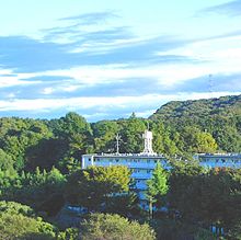
Machida ( Japanese 町 田 市 , - shi ) is a city in Tokyo Prefecture .
In addition to extensive residential areas, the city also has hills and large parks , botanical gardens and some agriculture with rice terraces. Machida is home to many of the commuters who travel to central Tokyo for work every day. As fewer and fewer families can afford to buy a house in the Tokyo metropolitan area, they move to Machida, which made Machida grow faster and faster. Some of the city's recreational areas are Nozuta Park, Dahlia Garden, Botan Park, and Yakushi-Ike Park.
traffic
- Street:
- Tōmei Highway
- National road 16
- National Road 246
- Railroad:
- Odakyū Odawara Line : from Machida , Tamagawa-Gakuen-mae and Tsurukawa to Shinjuku or Odawara
- JR Yokohama Line , from Aihara , Machida and Naruse to Higashi-Kanagawa and Hachiōji
- Tōkyū Den'entoshi Line : Minami-Machida , Suzukakedai and Tsukushino stations
- Keiō Sagamihara Line : Tamasakai Station
sons and daughters of the town
- Ryōta Aoki (* 1996), football player
- Gō Hayama (* 1993), football player
- Yoshiaki Maruyama (born 1974), football player
- Ryūki Miura (born 1992), football player
- Suguru Osako (* 1991), long-distance runner
- Shōta Saitō (* 1994), football player
- Satoshi Tajiri (* 1965), head of Game Freak , and inventor of the well-known RPG series Pokémon
Neighboring cities and communities
- Tokyo prefecture
- Kanagawa Prefecture
Web links
Commons : Machida, Tokyo - Collection of images, videos and audio files


