Chofu
| Chōfu-shi 調 布 市 |
||
|---|---|---|
| Geographical location in Japan | ||
|
|
||
| Region : | Kanto | |
| Prefecture : | Tokyo | |
| Coordinates : | 35 ° 39 ' N , 139 ° 32' E | |
| Basic data | ||
| Surface: | 21.53 km² | |
| Residents : | 239,650 (October 1, 2019) |
|
| Population density : | 11,131 inhabitants per km² | |
| Community key : | 13208-0 | |
| Symbols | ||
| Flag / coat of arms: | ||
| Tree : | Camphor tree | |
| Flower : | Lagerstroemia indica | |
| Bird : | Zosterops japonicus | |
| town hall | ||
| Address : |
Chōfu City Hall 2 - 35 - 1 , Kojima-chō Chōfu -shi Tōkyō 182-8511 |
|
| Website URL: | http://www.city.chofu.tokyo.jp | |
| Location of Chofu in Tokyo Prefecture | ||
Chōfu ( Japanese 調 布 市 , - shi ) is a city in Tokyo Prefecture , about 20 km west of central Tokyo .
history
The area of the later city of Chōfu was populated at the latest since the Jōmon period , up to the Edo period 18 individual villages emerged.
In 1893 the area of Tokyo Prefecture was added. On April 1, 1955 , with the amalgamation of the two communities Chofu-machi and Jindai-machi, the city of Chofu was finally founded, which then had about 45,000 inhabitants.
geography
Chōfu is on the left bank of the Tama , which marks the border with Kawasaki (Kanagawa) and Inagi in the south and southeast. In the west Chōfu borders on Fuchū , in the north on Koganei and Mitaka and in the east on Setagaya and Komae .
traffic
About three kilometers north of the city center there is the small airport Chofu .
- Street:
- Chūō Highway : to Tōkyō or Nagoya
- National road 20 : to Tōkyō or Shiojiri
- Train:
sons and daughters of the town
- Kondō Isami (1834–1868), samurai
- Masato Nakamura (* 1958), composer and bassist
- Ikuo Yamahana (* 1967), politician
- Mika Ninagawa (* 1972), photographer and film director
- Ryōhei Shirasaki (* 1993), football player
- Hiroki Sugajima (* 1995), soccer player
- Rei Hirakawa (* 2000), soccer player
Sports
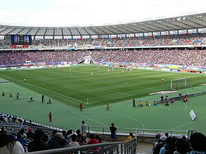
The Ajinomoto Stadium is the home of football clubs FC Tokyo and Tokyo Verdy from the J. League .
Neighboring cities and communities
- Tokyo prefecture
- Kanagawa Prefecture
Town twinning
-
 Kijimadaira , Japan
Web links
Individual evidence
- ↑ 調 布 市 の あ ゆ み. Retrieved June 7, 2020 .


