Traffic in the Tokyo metropolitan area
The Tokyo metropolitan area is the most important hub of road, rail, ship and air traffic in Japan . The metropolitan area includes the 23 districts of Tokyo (the actual core city of Tokyo ) and the rest of Tokyo Prefecture , as well as parts of the Chiba , Ibaraki , Kanagawa and Saitama prefectures . These include the megacities of Yokohama , Kawasaki and Saitama as well as several other large cities.
Air traffic
There are two first class airports in the Tokyo metropolitan area . The older one is Haneda Airport , which opened in 1931 . It is located in the Ōta district on Tokyo Bay , about 14 kilometers south of the city center. With 68.9 million passengers in 2013, it is the fourth largest airport in the world (after Atlanta , Beijing and London Heathrow ). From 1978 onwards, Haneda operated almost exclusively domestic flights, and since the opening of a new terminal in 2010 it has also been used again for international flights.
Near the city of Narita in Chiba Prefecture , about 60 kilometers east of the center of Tokyo, is the Narita Airport . In 2013 it counted 35.3 million passengers, which is the 38th place in the list of the world's largest airports. Narita was created as a relief for Haneda and, after its opening in 1978, handled almost all international air traffic. Today Narita is Japan's second largest airport and the tenth largest cargo airport in the world.
The Ibaraki Airport in Omitama in Ibaraki Prefecture is located 85 kilometers north of Tokyo. It opened in 2010 on the site of the Hyakuri Air Force Base and is primarily used as a base for low-cost airlines . Chofu Airport in the city of Chofu , 20 km west of Tokyo, is carried by the port authority of the prefecture administration and is mainly responsible for air traffic to the Izu Islands , an archipelago belonging to Tokyo prefecture. The also prefectural Tōkyō Heliport in the Kōtō district is a helipad for charter flights in the Tokyo area and to the airports.
Rail transport
Overview

Railways are the main mode of transport in the Tokyo metropolitan area. It has the densest and most widely used urban rail network in the world. In October 2003, public transport was used around 41 million times a day, which corresponds to around 57 percent of the total volume of traffic. At that time the entire rail network was 2,861 km long and had 1,243 stations. After the Second World War, when the actual suburbanization began and today's metropolitan area had around two thirds fewer inhabitants, most of the railway network was already in place. This contributed significantly to the fact that the engine started comparatively late. There are 882 train stations in central Tokyo , 282 of which are on the subway. Despite several capacity expansions trains are in the rush hours often crowded and there are Oshiya ( "pushers") used to the passengers in the car to push in. Most of Tokyo’s rail lines are owned by private companies; State-owned are the Toei subway (operated directly by the prefecture) and the lines of the company Tōkyō Metro (operated indirectly by the prefecture and the Japanese state). The busiest train station in Tokyo (and one of the busiest in the world) is Shinjuku in the district of the same name with around three million passengers a day.
Japan Rail
The East Japan Railway Company (or JR East; English for JR Higashi-Nihon , "JR East Japan ") is one of the world's largest railway companies for passenger transport. It operates rail lines in the entire metropolitan area of Tokyo and in the rest of the northeastern part of the Japanese main island of Honshu . In addition to the Shinkansen high-speed lines in standard gauge (1435 mm) going north , JR East is responsible for an extensive suburban rail network in Cape gauge (1067 mm). The Tōkaidō Shinkansen to Nagoya and Osaka is operated by the JR Tōkai ("JR Tōkai "; English "JR Central").

JR lines in and through Tokyo city center:
- Chūō Main Line : from Tokyo Station to Takao Station in Hachiōji
- Keihin-Tōhoku Line : from Ōmiya to Yokohama
- Keiyō Line : from Tokyo Station to Chiba
- Sōbu main line : from Tokyo Station to Chiba
- Tōkaidō Main Line : from Tokyo Station via Kawasaki , Yokohama and Odawara to Atami
- Utsunomiya Line: Section of the Tōhoku main line between Ueno Station and Nasushiobara
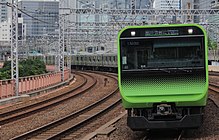
- Yamanote Line : Ring line around downtown Tokyo
- Yokosuka Line : from Tokyo Station via Shin-Kawasaki and Yokohama to Yokosuka
JR lines outside the city center:
- Hachikō Line : from Hachiōji to Takasaki
- Itsukaichi Line : from Akiruno to Akishima
- Jōban line : from Nippori via Matsudo to Toride
- Jōetsu Line : Suburban traffic north of Takasaki
- Kawagoe Line : from Ōmiya to Hidaka
- Musashino Line : from Fuchū to Funabashi
- Ōme Line : from Tachikawa to Okutama
- Nambu Line : from Kawasaki to Tachikawa
- Negishi Line : from Hachiōji via Yokohama to Kamakura
- Sagami Line : from Chigasaki to Hashimoto
- Takasaki Line : from Ōmiya to Takasaki
- Tsurumi Line : from Tsurumi to Kawasaki Port
- Yokohama Line : from Higashi-Kanagawa via Machida to Hachiōji
Other railway companies in the center of Tokyo
Regional trains transport commuters from the suburbs to central Tokyo. This includes various private railway companies with a total of 55 lines. These companies operate 24 other lines outside of Tokyo.
- Keihin Kyūkō Dentetsu : from Shinagawa Station to Kanagawa Prefecture and Haneda Airport (5 lines, track width 1435 mm)
- Keiō Dentetsu : from Shinjuku Station and Shibuya Station to western Tokyo (6 lines, gauge 1067 and 1372 mm)
- Keisei Dentetsu : from Ueno Station to Chiba Prefecture and Narita Airport (7 lines, gauge 1067 and 1435 mm)
- Odakyū Dentetsu : from Shinjuku Station to Kanagawa Prefecture (3 lines, track 1067 mm)
- Seibu Tetsudō : from Seibu-Shinjuku station and from Ikebukuro station to western Tokyo (13 lines, track 1067 mm)
- Tōbu Tetsudō : from Ikebukuro Station and Asakusa Station to the north and east of Tokyo and to Saitama Prefecture (13 lines, gauge 1067 mm)
- Tōkyō Kyūkō Dentetsu : from Shibuya Station and Meguro Station to southern Tokyo and Yokohama (7 lines, gauge 1067)
- Shutoken Shintoshi Tetsudō (English "Metropolitan Intercity Railway"): Tsukuba-Express from Akihabara station to Tsukuba in Ibaraki prefecture (1 line, gauge 1067 mm)
- Tokyo Waterfront Area Rapid Transit (English for Tōkyō Rinkai Kōsoku Tetsudō ): Rinkai line in the port area to the island of Odaiba (gauge 1067 mm)
Subways
Two companies operate the 310 km long and 13 line network of the Tokyo subway :
- Tōkyō Metro (formerly Eidan ): operator of nine lines (track width 1435 mm)
- Tokyo Prefecture Transportation Office : Operator of the four lines of the prefectural (toei) subway (track width 1435 mm)
Also in the metropolitan area is the Yokohama subway with 2 lines totaling 53.5 km in length. The operator is the Yokohama City Traffic Office .
Other railways and track-guided railways
Other railways of various types are in operation in the metropolitan region.
- Chiba Monorail : suspension railway in Chiba (2 lines)
- Disney Resort Line : Monorail from Maihama Station to Tokyo Disney Resort
- Enoshima-Dentetsu Line : from Kamakura to Fujisawa (gauge 1067 mm)
- Hokusō Line : from Katsushika to Inzai (gauge 1435 mm)
- Kanazawa Seaside Line : People mover in Yokohama
- New Shuttle : rubber-tyred train from Ōmiya to Ina
- Nippori-Toneri Liner , people mover in northeast Tokyo between Arakawa and Adachi
- Nagareyama Line : from Matsudo to Nagareyama (gauge 1067 mm)
- Sagami Tetsudō : from Yokohama to Ebina and Fujisawa (2 lines, track width 1067 mm)
- Saitama Kōsoku Tetsudō : from Kita to Midori-ku (gauge 1067 mm)
- Shibayama Tetsudō : from Narita Airport to Shibayama (track width 1435 mm)
- Shin-Keisei Dentetsu : from Narashino to Matsudo (track width 1435 mm)
- Shōnan Monorail : Suspension railway in Kamakura
- Tama Monorail : Monorail from Tama to Higashiyamato
- Tōyō Kōsoku : from Funabashi to Yachiyo (gauge 1067 mm)
- Tōkyō Monorail : Monorail from Hamamatsuchō Station to Haneda Airport
- Ueno Zoo Monorail , suspension railway in the Ueno Zoo
- Yūkarigaoka Line : People mover in Yūkarigaoka, Sakura
- Yokohama Kōsoku Tetsudō (English "Yokohama Minatomirai Railway"): 2 lines in Yokohama (gauge 1067 mm)
- Yurikamome : People mover in the port area
Bus and tram
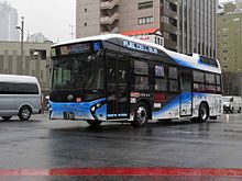
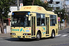
Bus lines usually play a secondary role in the Tokyo metropolitan area and primarily serve as feeders to the train stations. Exceptions are long-distance buses and shuttle buses to the airports. The Tokyo Prefecture Transportation Office carries the prefectural buses ( Toei Bus ) , which have an almost monopoly position in downtown Tokyo. Several special districts and other municipalities in Tokyo also maintain municipal buses, especially for local traffic, so-called community buses ( コ ミ ュ ニ テ ィ バ ス ). In the remaining areas there are various subsidiaries of the private railway companies mentioned above. Several cities such as Yokohama and Kawasaki have their own urban bus operations. Some operators offer combined bus / train tickets; there are also discounted rates for children, senior citizens and disabled people.
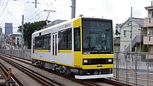
The Toden-Arakawa line is also operated by the Tokyo Prefecture Transportation Office . This 12.2 km long tram line with a gauge of 1372 mm is the last remaining line of the former urban tram network ( Tōkyō Shiden , since 1943 prefecture tram , Tōkyō Toden ). The railway company Tōkyō Kyūkō Dentetsu operates the 5.0 km long Setagaya line in the Setagaya district of the same name (gauge 1372 mm), which is routed as a light rail, but is legally considered a tram.
Road traffic

Regional and local road network
National roads , prefecture roads and municipal roads form a close-knit network. The main roads include:
- National Road 1 : connects Tokyo with Osaka and follows the course of the historic Tōkaidō
- National Road 4 : leads to Aomori via Utsunomiya , Kōriyama and Sendai
- National road 6 : leads via Iwaki to Sendai
- National Road 14 : connects Tokyo with Chiba Prefecture
- National Road 15 : connects Tokyo with Yokohama
- National Road 16 : is a major ring road around Tokyo
- National road 17 : leads to Niigata via Saitama and Maebashi
- National Road 20 : crosses Tokyo from east to west and continues to Yamanashi Prefecture
The Nihombashi , a bridge in the Chūō district , is the starting point of the national roads starting in Tokyo and the reference point for distance information. As is common in Japan, only a few major streets have names at all. Instead, several closely assembled blocks of houses are usually referred to according to their geographical location, distinctive buildings or well-known shops.
Highways

The company Shuto Kōsokudōro ("Capital Highways", English Shuto Expressway ) operates an approximately 300 km long motorway network, which mainly opens up the districts in the eastern part of Tokyo prefecture , but also extends into neighboring prefectures Kanagawa , Saitama and Chiba . The Inner Ring (C1) and the Middle Ring (C2) are particularly important , the other motorways are predominantly radial routes.
From the company Higashi-Nihon Kōsokudōro ("East Japanese Highway [en]"; English NEXCO East ) are among other things the Tōkyō-wan-Aqua-Line and the Tōkyō-Gaikan-Autobahn (English "Tokyo Gaikan Expressway" for Tōkyō gaikan jidōshadō) , “Tokyo Outer Ring Road”). The former is a bridge / tunnel to cross Tokyo Bay , the latter a partially completed outer ring road in the north of the metropolitan area.
Several supraregional highways meet in Tokyo, including the Tōmei highway via Yokohama and Shizuoka to Komaki (north of Nagoya ), the Chūō highway via Kofu to Komaki, the Kan'etsu highway to Niigata and the Tōhoku highway via Sendai to Aomori .
shipping
The port of Tokyo is one of the largest in the Pacific Ocean . It is located at the mouth of the Sumida River and includes several artificial islands in Tokyo Bay . It is administered by the Tokyo Prefecture Port Authority. In 2011, 26,538 ships with a handling volume of 83.39 million tons were handled. To the south of Tokyo Harbor, separated by Haneda Airport, borders the urban port of Yokohama . In 2009 he shipped 37,106 115.54 million tons of goods.
The Tokyo-Wan Ferry , a car and passenger ferry across Tokyo Bay , runs between Yokosuka in Kanagawa Prefecture and Futtsu in Chiba Prefecture . Other shipping lines in the bay are largely used for excursion traffic. Important providers are Tokyo Cruise Ship and Tokyo Mizube Line in Tokyo as well as The Port Service and Keihin Ferry Boat in Yokohama.
From Tokyo and Yokohama there are ships to the Izu Islands , the Bonin Islands , the Amami Islands and Okinawa .
Web links
- Unofficial map of the railway lines. flickr.com (English)
- Map of the railway lines. JR East (Japanese)
Individual evidence
- ↑ a b Top 50 worldwide airport comparisons. (PDF; 3.6 MB) In: Airport Traffic Report. Port Authority of New York and New Jersey , April 1, 2014, p. 32 , accessed June 28, 2015 .
- ↑ ACI Annual world airport traffic report 2013. Airports Council International , April 1, 2014, accessed on December 22, 2014 (English).
- ↑ Tokyo-Yokohama Suburban Rail Summary. (PDF; 103 kB) In: Urban Transport Fact Book. The Public Purpose, 2003, accessed June 28, 2015 .
- ↑ Roman Cybriwsky (ed.): Historical Dictionary of Tokyo . Scarecrow Press, Lanham MD 2011, ISBN 978-0-8108-7489-3 , pp. 222 .
- ↑ Statistics. Bureau of Port and Harbor Tokyo Metropolitan Government, 2012, accessed December 22, 2014 .
- ^ Outline of the port of Yokohama. City of Yokohama Port & Harbor Bureau, 2012, accessed December 22, 2014 .


