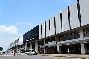
Nasushiobara
| Nasushiobara-shi 那 須 塩 原 市 |
||
|---|---|---|
| Geographical location in Japan | ||
|
|
||
| Region : | Kanto | |
| Prefecture : | Tochigi | |
| Coordinates : | 36 ° 58 ' N , 140 ° 3' E | |
| Basic data | ||
| Surface: | 592.82 km² | |
| Residents : | 116,043 (October 1, 2019) |
|
| Population density : | 196 inhabitants per km² | |
| Community key : | 09213-4 | |
| Symbols | ||
| Flag / coat of arms: | ||
| Tree : | jaw | |
| Flower : | Rhododendron albrechtii | |
| town hall | ||
| Address : |
Nasushiobara City Hall 108 - 2 , Kyōkonsha Nasushiobara shi Tochigi 325-8501 |
|
| Website URL: | http://www.city.nasushiobara.lg.jp | |
| Location of Nasushiobaras in Tochigi Prefecture | ||
Nasushiobara ( Japanese 那 須 塩 原 市 , -shi ) is a city in Tochigi Prefecture in Japan .
geography
Nasushiobara is north of Utsunomiya and south of Shirakawa .
history
The city of Nasushiobara was founded on January 1, 2005 from the city of Kuroiso ( 黒 磯 市 , -shi ), and the communities of Nishinasuno ( 西 那 須 野 町 , -machi ) and Shiobara ( 塩 原 町 , -machi ) of the Nasu County.
traffic
- Street:
- Train:
- JR Tōhoku Shinkansen , Nasu-Shiobara Station , to Tokyo or Hachinohe
sons and daughters of the town
- Yōko Shibui (* 1979), long-distance runner
- Yoshimi Watanabe (* 1952), politician
- Hirayama Aya , actress and idol
Neighboring cities and communities
- Tochigi prefecture
- Fukushima prefecture
Town twinning
-
 Hitachinaka , Japan, since 1990
 -
 Namerikawa , Japan, since 1996
 -
 Niiza , Japan, since 2000
 - Linz , Austria, since 2016
Web links
Commons : Nasushiobara - collection of images, videos and audio files
Individual evidence
- ^ Regional media Austria: Japan meets Linz: Delegation visited twin city. Retrieved August 24, 2016 .


