Mooka
| Mooka-shi 真 岡 市 |
||
|---|---|---|
| Geographical location in Japan | ||
|
|
||
| Region : | Kanto | |
| Prefecture : | Tochigi | |
| Coordinates : | 36 ° 26 ' N , 140 ° 1' E | |
| Basic data | ||
| Surface: | 111.76 km² | |
| Residents : | 79,109 (October 1, 2019) |
|
| Population density : | 708 inhabitants per km² | |
| Community key : | 09209-6 | |
| Postal code area : | 321-4301-321-4545 | |
| Symbols | ||
| Flag / coat of arms: | ||
| Tree : | Japanese zelkove | |
| Flower : | cotton | |
| Bird : | Skylark | |
| town hall | ||
| Address : |
Mooka City Hall 5191 Ara-machi Mooka -shi Tochigi 321-4395 |
|
| Website URL: | http://www.city.moka.tochigi.jp | |
| Location Mookas in Tochigi Prefecture | ||
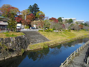
Mooka ( Japanese 真 岡 市 , - shi ) is a city in Tochigi Prefecture in Japan .
geography
Mooka is northeast of Oyama and southeast of Utsunomiya .
history
On March 31, 1954, the villages of Naka ( 中 村 , -mura ), Ōuchi ( 大 内 村 , -mura ) and Yamazaki ( 山前 村 , -mura ) were incorporated into the district of Haga . On October 1st, the Mo'oka ( 真 岡 町 , -machi ) community received town charter .
traffic
- Street:
- National roads 121, 294, 408
- Train:
- Mooka Line , after Motegi
Town twinning
Neighboring cities and communities
Web links
Commons : Mooka - collection of images, videos and audio files


