Nishigō (Fukushima)
| Nishigō-mura 西 郷 村 |
||
|---|---|---|
|
|
||
| Geographical location in Japan | ||
| Region : | Tōhoku | |
| Prefecture : | Fukushima | |
| Coordinates : | 37 ° 9 ' N , 140 ° 9' E | |
| Basic data | ||
| Surface: | 192.06 km² | |
| Residents : | 20,457 (April 1, 2020) |
|
| Population density : | 107 inhabitants per km²
|
|
| Symbols | ||
| Flag / coat of arms: | ||
| Tree : | Japanese emperor oak | |
| Flower : | White mock kalla | |
| Flowering : | Rhododendron pentaphyllum var. Nikoense | |
| Bird : | Colored pheasant | |
| town hall | ||
| Address : |
Nishigō Village Hall 40 Aza Orikuchihara, Ōaza Kumakura Nishigō -mura, Nishishirakawa-gun Fukushima 07461-6 |
|
| Website URL: | http://www.vill.nishigo.fukushima.jp/ | |
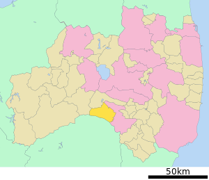
| Location of Nishigō in Fukushima Prefecture | ||
Nishigō ( Japanese 西 郷 村 , - mura ) is a Japanese village in Nishishirakawa County in Fukushima Prefecture .
geography
Nishigō is located in the central Nakadōri region of Fukushima between the Abukuma highlands in the east and the Ōu mountains in the west. The eastern part of the community is located in the Shirakawa Basin ( 白河 盆地 Shirakawa-bonchi ) at about 500 m altitude, while the majority of the community extends over the Kashi Plateau ( 甲子 高原 Kashi-kōgen ) to about 800 m altitude, which extends up to to the foot of 1549 m TP high Kashi-Zan ( 甲子山 extends). The highest point is the 1916.9 m TP high Sambon'yari-dake ( 三 本 槍 岳 ) in the southwest, which belongs to the Nasu-dake volcano massif. The Abukuma flows through the plateau .
The neighboring communities are in clockwise direction Shirakawa in the northeast and east, Nasu in the southeast, Nasushiobara in the southwest, Shimogō in the west, and Ten'ei in the northwest.
history
The community was established on April 1, 1889 during the reorganization of the Japanese community system from the western villages ( nishigō ) of Nishishirakawa County: Kumakura ( 熊 倉 村 ), Habuto ( 羽 太 村 ), Mabune ( 真 船 村 ), Odakura ( 小田 倉 村 ), Yone ( 米 村 ), Nagasaka ( 長坂 村 ), Kashiwano ( 柏 野村 ) and Tsuryū ( 鶴 生 村 ).
The natural disaster of the Tōhoku earthquake on March 11, 2011 resulted in 5 deaths in Nishigō. 43 residential buildings were completely destroyed and 305 others partially destroyed.
Attractions
The biggest tourist attractions are the hot springs ( onsen ) Kashi Onsen ( 甲子 温泉 ) and Shin-Kashi Onsen ( 新 甲子 温泉 ) at the foot of the Kashi mountain.
The 81.8 m long Yukiwari Bridge ( 雪 割 橋 -bashi ) over the 50 m deep Yukiwari Gorge ( 雪 割 渓 谷 -keikoku ) of the Abukuma provides a good overview of the nature of the Kashi Plateau , especially in spring and autumn.
Until 2008, the community also had a winter sports area with the Shirakawa-Kōgen ski resort.
traffic
There is a connection to the Japanese rail network via the JR East Tōhoku Shinkansen to Tokyo or Aomori , as well as the Tōhoku main line to Tokyo or Morioka .
The main highway is the Tōhoku highway to Kawaguchi or Aomori. The national road 4 leads to Tokyo or Aomori, the national road 289 to Niigata or Iwaki .
education
Nishigō has the primary schools Kumakura, Odakura, Yone, Habuto and Kawatani, as well as the 1st middle school Nishigō, the 2nd middle school Nishigō and the middle school Kawatani. There is no regular high school of its own, but the prefecture runs a school here for physically handicapped children.
Web links
Individual evidence
- ↑ 平 成 23 年 (2011 年) 東北 地方 太平洋 沖 地震 (東 日本 大 震災) に つ い て (第 157 報) ( Memento of March 18, 2018 on WebCite ) ( PDF ( Memento of March 18, 2018 on WebCite )), 総 務 省 消防庁 (Fire and Disaster Management Agency), 157th report, March 7, 2018.
- ↑ 雪 割 橋 . In: 全国 観 光 情報 サ イ ト . Japan Tourism Association, accessed August 5, 2018 (Japanese).


