Shirakawa (Fukushima)
| Shirakawa-shi 白河 市 |
||
|---|---|---|
| Geographical location in Japan | ||
|
|
||
| Region : | Tōhoku | |
| Prefecture : | Fukushima | |
| Coordinates : | 37 ° 8 ' N , 140 ° 13' E | |
| Basic data | ||
| Surface: | 305.30 km² | |
| Residents : | 59,406 (April 1, 2020) |
|
| Population density : | 195 inhabitants per km² | |
| Community key : | 07205-2 | |
| Symbols | ||
| Flag / coat of arms: | ||
| Tree : | Japanese red pine | |
| Flower : | Ume | |
| Bird : | Meadow bunting | |
| town hall | ||
| Address : |
Shirakawa City Hall 7 - 1 , Hachimankōji Shirakawa -shi Fukushima 961-8602 |
|
| Website URL: | http://www.city.shirakawa.fukushima.jp/ | |
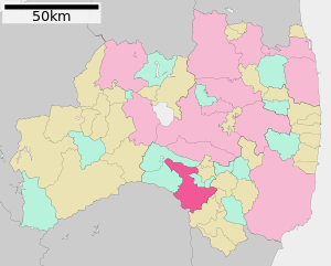
| Location of Shirakawas in Fukushima Prefecture | ||
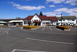
Shirakawa ( Japanese 白河 市 , -shi ) is a city in Fukushima Prefecture in Japan .
geography
Shirakawa is north of Utsunomiya and Nasushiobara , and south of Kōriyama and Fukushima .
history
Shirakawa had owned a castle since the 13th century and was expanded into a castle town in the Edo period , where a line of the Abe with an income of 100,000 koku last resided.
On April 1, 1949 , the place received city rights.
On March 11, 2011, the city was hit by the Tōhoku earthquake . About 200 houses were completely or partially destroyed and 12 dead were counted by May 20.
Attractions
traffic
- Tōhoku Highway
- National road 4
- National roads 289 and 294
Twin town
- Compiègne , Département Oise , France (since 1988)
sons and daughters of the town
- Atsushi Fujita (* 1976), long-distance runner
- Gishū Nakayama (1900–1969), writer
Neighboring cities and communities
- Fukushima prefecture
- Tochigi prefecture
Individual evidence
- ↑ 東 日本 大 震災 図 説 集 . In: mainichi.jp. Mainichi Shimbun- sha, May 20, 2011, archived from the original on June 19, 2011 ; Retrieved June 19, 2011 (Japanese, overview of reported dead, missing and evacuated).
Web links
Commons : Shirakawa - collection of images, videos and audio files


