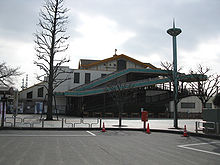
Akiruno
| Akiruno-shi あ き る 野 市 |
||
|---|---|---|
|
|
||
| Geographical location in Japan | ||
| Region : | Kanto | |
| Prefecture : | Tokyo | |
| Coordinates : | 35 ° 44 ' N , 139 ° 18' E | |
| Basic data | ||
| Surface: | 73.34 km² | |
| Residents : | 80,074 (October 1, 2019) |
|
| Population density : | 1092 inhabitants per km² | |
| Community key : | 13228-4 | |
| Symbols | ||
| Flag / coat of arms: | ||
| Tree : | Scented flower | |
| Flower : | Garden chrysanthemum | |
| Bird : | stilt | |
| town hall | ||
| Address : |
Akiruno City Hall 350 Ninomiya Akiruno -shi Tōkyō 197-0814 |
|
| Website URL: | http://www.city.akiruno.tokyo.jp | |
| Location Akirunos in Tokyo Prefecture | ||
Akiruno ( Japanese あ き る 野 市 , - shi ) is a city in the Japanese prefecture of Tokyo, west of Tokyo .
geography
Akiruno is west of Tokyo , south of Ōme and north of Hachioji .
history
The town was founded on 1 September 1995 by the merger of the independent city Akigawa ( 秋川市 , -shi ) and the city Itsukaichi ( 五日市町 , - machi ) of the district Nishitama .
traffic
- Train:
- Street:
- National road 411
Town twinning
-
 Kurihara , since 1985 as Shiwahime then Itsukaichi
 -
 Ōshima , since 1985 as Itsukaichi
 -
 Marlborough, Massachusetts , since 1998
Neighboring cities and communities
Web links
Commons : Akiruno - collection of images, videos and audio files


