Mitaka
| Mitaka-shi 三 鷹 市 |
||
|---|---|---|
| Geographical location in Japan | ||
|
|
||
| Region : | Kanto | |
| Prefecture : | Tokyo | |
| Coordinates : | 35 ° 41 ' N , 139 ° 34' E | |
| Basic data | ||
| Surface: | 16.50 km² | |
| Residents : | 192,489 (October 1, 2019) |
|
| Population density : | 11,666 inhabitants per km² | |
| Community key : | 13204-7 | |
| Symbols | ||
| Flag / coat of arms: | ||
| Tree : | ginkgo | |
| Flower : | Hall's apple | |
| town hall | ||
| Address : |
Mitaka City Hall 1 - 1 - 1 , Nozaki Mitaka -shi Tōkyō 182-8555 |
|
| Website URL: | http://www.city.mitaka.tokyo.jp | |
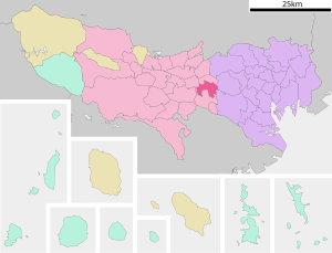
| Location Mitakas in Tokyo Prefecture | ||
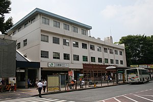
Mitaka ( Japanese 三 鷹 市 , - shi ) is a city in Tokyo Prefecture, west of Tokyo .
geography
Mitaka is west of Tokyo , south of Musashino , east of Koganei and north of Chofu .
history
The village Mitaka ( 三鷹村 ) was founded in 1889 in the district of North Tama ( Kita-tama-gun founded) Kanagawa. In 1893 the district came to Tokyo. The city of Mitaka ( 三 鷹 町 ) was founded in 1940. The urban district Mitaka described here was founded on November 3, 1950 . The asteroid (1088) Mitaka , discovered on November 17, 1927, is named after the place; facilities of the National Astronomical Observatory of Japan are also located in Mitaka.
Attractions
Inokashira Park is on the border with Musashino . The Ghibli Museum of the world-famous cartoon studio of the same name is also located there .
traffic
- Train:
- JR Chūō-Sōbu Line : to Akihabara , Shinjuku and Chiba
- JR Chūō Main Line : to Tokyo or Hachioji
- Keiō Inokashira Line : to Shibuya
- Street:
education
There are several private universities in Mitaka: Kyōrin University , International Christian University , Luther Gakuin University and the Tokyo Theological Seminary . In addition, the Institute for Astronomy of the University of Tokyo and the Astronomy Department of the Sōkendai are located in Mitaka .
sons and daughters of the town
- Hiroki Azuma (* 1971), cultural critic
- Keishi Kusumi (* 1994), soccer player
- Satoshi Ōno (* 1980), singer and actor
- Satoru Ōtomo (* 1957), astronomer
- Wataru Sasaki (* 1996), football player
- Yūko Tsushima (1947–2016), writer


