Nishitōkyō
| Nishitōkyō-shi 西 東京 市 |
||
|---|---|---|
| Geographical location in Japan | ||
|
|
||
| Region : | Kanto | |
| Prefecture : | Tokyo | |
| Coordinates : | 35 ° 44 ' N , 139 ° 32' E | |
| Basic data | ||
| Surface: | 15.85 km² | |
| Residents : | 205,801 (October 1, 2019) |
|
| Population density : | 12,984 inhabitants per km² | |
| Community key : | 13229-2 | |
| Symbols | ||
| Flag / coat of arms: | ||
| Tree : | Japanese zelkova , flower dogwood | |
| Flower : |
Azalea (spring), sunflower (summer), decorative basket (autumn), daffodil (winter) |
|
| Song : | Daisuki desu, Nishitōkyō (Nishitōkyō, that is love) | |
| town hall | ||
| Address : |
Nishitōkyō City Hall 5 - 6 - 13 , Minami-chō Nishitōkyō -shi Tōkyō 188-8666 |
|
| Website URL: | http://www.city.nishitokyo.lg.jp | |
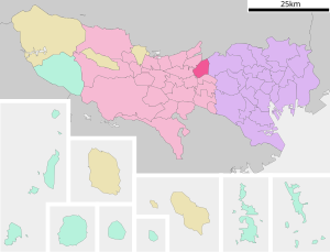
| Location of Nishitōkyō in Tokyo Prefecture | ||
Nishitōkyō ( Japanese 西 東京 市 , - shi ; literally: "West Tōkyō ") is a city in Tokyo Prefecture, west of Tokyo .
geography
Nishitōkyō is located west of Tokyo .
history
The city was founded on January 21, 2001 as a merger of the cities of Hōya and Tanashi .
traffic
- Train:
- Seibu Ikebukuro Line : to Tokorozawa and Ikebukuro
- Seibu Shinjuku Line : to Shinjuku and Kawagoe
Sports
Nishitōkyō was the seat of the ice hockey team Seibu Prince Rabbits .
Personalities
- Shōta Fukuoka (* 1995), football player
- Aoi Miyazaki (born 1985), actress
- Mitsunari Musaka (* 1991), soccer player
- Kyary Pamyu Pamyu (* 1993), singer, model, blogger
Neighboring cities and communities
Web links
Commons : Nishitōkyō - collection of images, videos and audio files


