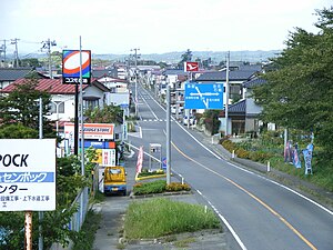
Kurihara
| Kurihara-shi 栗 原 市 |
||
|---|---|---|
| Geographical location in Japan | ||
|
|
||
| Region : | Tōhoku | |
| Prefecture : | Miyagi | |
| Coordinates : | 38 ° 44 ' N , 141 ° 1' E | |
| Basic data | ||
| Surface: | 804.93 km² | |
| Residents : | 65,313 (October 1, 2019) |
|
| Population density : | 81 inhabitants per km² | |
| Community key : | 04213-7 | |
| Symbols | ||
| Flag / coat of arms: | ||
| town hall | ||
| Address : |
Kurihara City Hall 1 - 7 - 1 , Yakushi, Tsukidate Kurihara -shi Miyagi 987-2293 |
|
| Website URL: | http://www.kuriharacity.jp/ | |
| Location of Kuriharas in Miyagi Prefecture | ||
Kurihara ( Japanese 栗 原 市 , - shi ) is a city in Miyagi Prefecture on Honshū , the main island of Japan .
geography
Kurihara is south of Ichinoseki and north of Sendai .
history
The city was formed on April 1, 2005 from the small towns of Tsukidate ( 築 館 町 , - machi ), Wakayanagi ( 若 柳 町 , -machi ), Kurikoma ( 栗 駒 町 , -machi ), Shiwahime ( 志 波 姫 町 , -machi ), Takashimizu ( 高清水 町 , -machi ), Ichihasama ( 一 迫 町 , -machi ), Semine ( 瀬 峰 町 , -machi ), Uguisuzawa ( 鶯 沢 町 , -machi ), Kannari ( 金 成 町 , -machi ) and the village of Hanayama ( 花 山村 , - mura ) of Kurihara County. The district was then dissolved.
In the Tōhoku earthquake of March 11, 2011 , Kurihara measured level 7 on the JMA scale, the highest seismic activity in all of Japan.
traffic
- Street:
- Tōhoku Highway
- National road 4 , to Tokyo or Aomori
- National Road 398,457
- Train:
- JR Tōhoku Shinkansen : Kurikoma-Kōgen Station
- JR Tōhoku main line
Neighboring cities and communities
- Miyagi Prefecture
- Akita Prefecture
- Iwate Prefecture
Town twinning
-
 Akiruno , Japan, since 1985
Web links
Commons : Kurihara - album with pictures, videos and audio files
Individual evidence
- ↑ Earthquake Information. Japan Meteorological Agency, archived from the original on April 7, 2011 ; accessed on August 8, 2011 .


