Atsugi
| Atsugi-shi 厚 木 市 |
||
|---|---|---|
| Geographical location in Japan | ||
|
|
||
| Region : | Kanto | |
| Prefecture : | Kanagawa | |
| Coordinates : | 35 ° 27 ' N , 139 ° 22' E | |
| Basic data | ||
| Surface: | 93.83 km² | |
| Residents : | 224,677 (October 1, 2019) |
|
| Population density : | 2395 inhabitants per km² | |
| Community key : | 14212-3 | |
| Symbols | ||
| Flag / coat of arms: | ||
| Tree : | maple | |
| Flower : | Rhododendron indicum | |
| Day : | February 1st | |
| town hall | ||
| Address : |
Atsugi City Hall 3 - 17 - 17 , Naka-machi Atsugi -shi Kanagawa 243-8511 |
|
| Website URL: | Atsugi | |
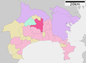
| Location Atsugis in Kanagawa Prefecture | ||
Atsugi ( Japanese 厚 木 市 , -shi ) is a city in Kanagawa Prefecture in Japan .
Within Japan, Atsugi is best known as a suburb of the metropolis Tokyo - Yokohama and is also associated with the US naval base in NAF Atsugi . However, this is not located in Atsugi, but lies between the two nearby towns of Ayase and Yamato .
The Air Force Base in Atsugi is located where American troops first entered the main island of Japan on August 28, 1945, heralding the end of World War II .
geography
Atsugi is south of Tokyo, west of Yokohama and Ebina , north of Hiratsuka and east of Isehara .
The Sagami flows through the city from north to south.
history
Atsugi received town charter on February 1, 1955.
traffic
- Street:
- Tōmei highway , direction Tokyo or Nagoya (toll)
- National Road 129, direction Fujisawa (Kanagawa) or Sagamihara
- National Road 246, direction Tokyo Center or Numazu
- National road 271, direction Odawara (toll)
- National Road 412, direction Tsukui
- Railroad:
- Odakyū Odawara Line , Hon-Atsugi and Atsugi stations, direction Shinjuku or Odawara
- JR East Sagami Line , Atsugi Station, direction Chigasaki or Sagamihara
Attractions
- Chokoku-ji (Iiyama Kannon)
- Iiyama Spa
- Nanasawa Spa
Other bodies
- Shōin University
- Aoyama Gakuin University , until moving to Sagamihara in 2003
- NTT Basic Research Laboratories
sons and daughters of the town
- Akira Amari (* 1949), politician
- Shōta Aoki (* 1990), football player
- Ryō Germain (born 1995), football player
- Kyōko Koizumi (born 1966), singer
- Teruyuki Moniwa (* 1981), football player
- Shinji Morita (* 1987), soccer player
- Genki Nagasato (* 1985), football player
- Yuki Nagasato (* 1987), soccer player
- Ryōhei Okazaki (* 1992), football player
Neighboring cities and communities
Web links
Commons : Atsugi - collection of images, videos and audio files


