
Moltketurm

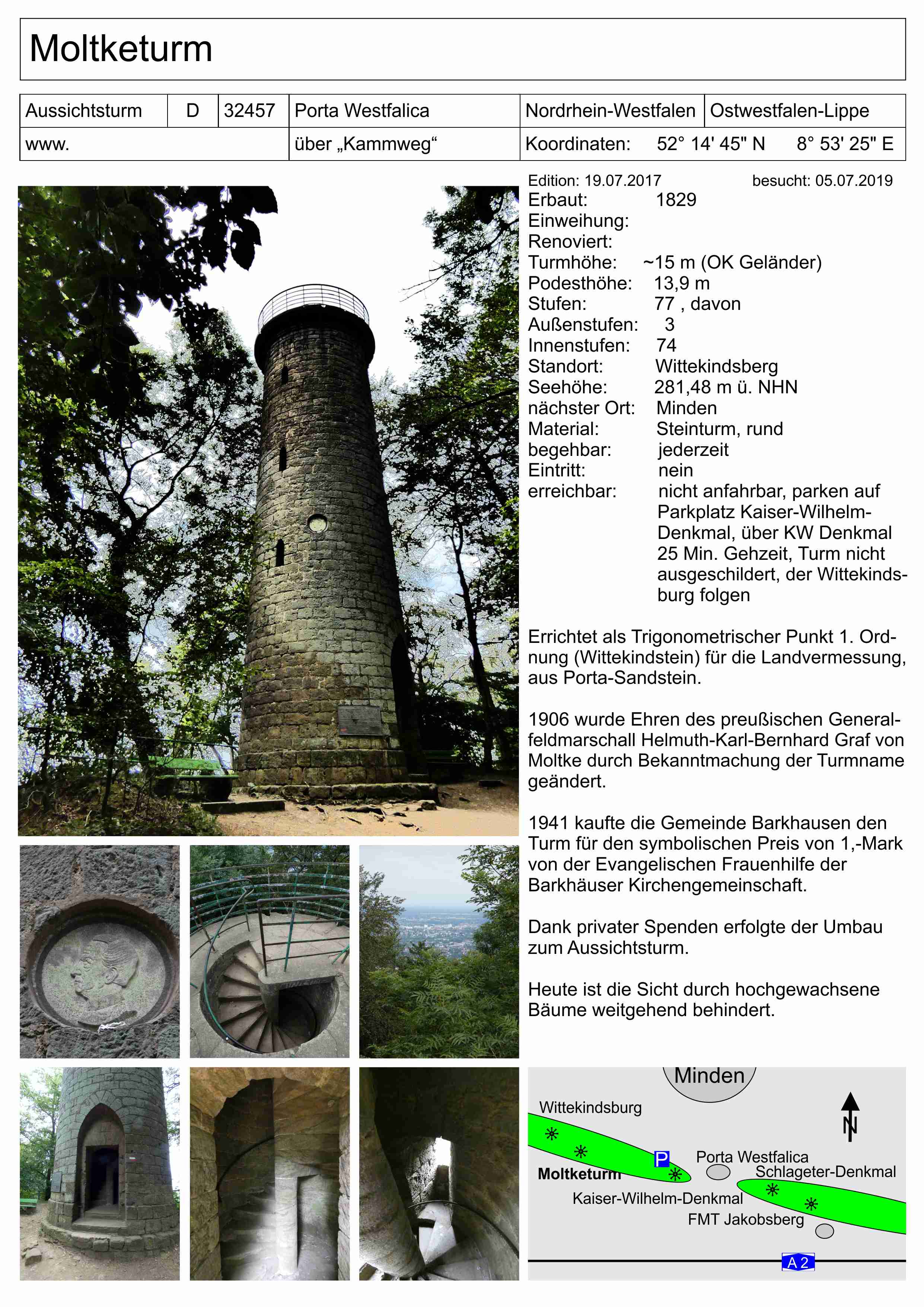
The Moltketurm is a lookout tower on the Wittekindsberg in the East Westphalian Wiehengebirge near Porta Westfalica . After overcoming 77 steps (74 of them inside), you reach the viewing platform at a height of 13.9 m. Due to the tall trees, the view of the surrounding mountains, the Weser Valley and a southern area of the North German Plain is unfortunately restricted. The tower stands on the ridge directly on the route of the Wittekindsweg , the European long-distance hiking trail E11 .
history
At the highest point of the Wittekindsberg ( 281.48 m ) stands the Moltketurm, which was built in 1828/1829 as the "Wittekindsstein" observation tower , about 1 km (as the crow flies ) west of the Kaiser Wilhelm monument . It was designed as a first order signal point for the national survey on the Wittekindsberg and is an idea of the chief geometer Johann Jacob Vorlaender (1799–1886). Heinrich-Ludwig Schuhmacher (1779–1856) at Gut Wedigenstein , who later raised the tower and provided it with a secure platform, was also involved in the financing . This made it available to the public. Porta sandstone was used as building material .
In 1906 it was renamed Moltketurm in honor of Field Marshal General Helmuth Karl Bernhard von Moltke (1800-1891), who visited this area in 1852. In 1941 the municipality of Barkhausen acquired the tower for the symbolic price of 1 Reichsmark .
Web links
Individual evidence
- ↑ Moltketurm
- ^ Wilhelm Schröder: The charitable foundations of Heinrich Ludwig Schumacher (1779-1856) and his son Carl Wittekind (1817-1870) in Wedigenstein. In: Messages from the Minden History Society. Vol. 61, 1989, ISSN 0340-188X , pp. 91-104.
- ↑ Fritz W. Franz Meyer: Porta Westfalica, Links der Weser. What has been handed down and experienced from a historical space . Books on demand 2013, page 339
- ↑ Fritz W. Franz Meyer: Porta Westfalica, Links der Weser. What has been handed down and experienced from a historical space . Books on demand 2013, page 339
- ↑ Information from the information board next to the tower
Coordinates: 52 ° 14 ′ 45.8 ″ N , 8 ° 53 ′ 25.5 ″ E