Mont Haut-Folin
| Mont Haut-Folin | ||
|---|---|---|
|
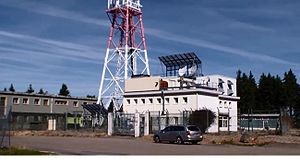
TV station on the summit |
||
| height | 901 m | |
| location | Saône-et-Loire , Bourgogne-Franche-Comté , France | |
| Mountains | Morvan | |
| Coordinates | 46 ° 59 '45 " N , 4 ° 2' 14" E | |
|
|
||
| Development | Driveway, hiking trails | |
| particularities | highest mountain in the Morvan and also in the Burgundy region | |
The Haut-Folin , with a height of 901 meters the highest mountain in the Morvan and in the former region of Burgundy .
description
The mountain is the closest ski resort in France to Paris. There is a television station on the summit. Since the summit itself is heavily forested, there is usually no view of the surroundings from there.
The Bibracte - Alesia long-distance hiking trail touches the mountain, but does not lead over the summit.
literature
- Thomas Rettstatt: Burgundy, 50 tours, Rother hiking guide. Bergverlag Rother , Munich 2012, pp. 120f., ISBN 978-3-7633-4408-6 .
Web links
Commons : Haut Folin - collection of images, videos and audio files

