Monte Sarmiento
| Monte Sarmiento | ||
|---|---|---|
|
Monte Sarmiento on the horizon in the center of the picture |
||
| height | 2246 m | |
| location | Tierra del Fuego , Chile | |
| Mountains | Cordillera Darwin | |
| Coordinates | 54 ° 27 ′ 0 ″ S , 70 ° 50 ′ 0 ″ W | |
|
|
||
| First ascent | 1956 by Carlo Mauri and Clemente Maffei | |
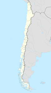
The Monte Sarmiento ( 2246 m ) is a pyramid-shaped and heavily glaciated mountain and is located in the Alberto De Agostini National Park in the Chilean part of Tierra del Fuego . It rises directly above the east coast of the Magdalena Canal and forms the western border of the Cordillera Darwin . The summit is usually covered in clouds, but when it is visible it is an impressive sight and has already been recognized in this way by Charles Darwin .
Ascent history
A few unsuccessful attempts were made to climb the summit, for example by William Martin Conway in 1898 and Alberto Maria De Agostini in 1913. Carlo Mauri and Clemente Maffei made the first ascent in 1956. Natalia Martínez and Camilo Rada made it in 2013 the second successful ascent. The mountain is very difficult to access, and the rapidly changing weather conditions rarely allow an ascent.
Naming
The researcher Pedro Sarmiento de Gamboa initially called the mountain "Volcán Nevado" (" snowy volcano ") because he thought that this mountain was a volcano . Philip Parker King named it "Mount Sarmiento" in honor of this researcher.
Individual evidence
- ^ A b c d Jack Miller: Exploring America's Southern Tip . American Alpine Journal , 1967, pp. 326-333 ( online )
- ↑ Natalia Martínez y Camilo Rada, segunda ascensión al Monte Sarmiento después de 57 años. Article in Spanish.
- ↑ P. Parker King: Voyages of the Adventure and Beagle, Volume I . 1838 edited by Henry Colburn
Web links
- arte.tv: The White Mountain ( Memento from November 11, 2013 in the Internet Archive )

