
Moorgraben (Mühlenau)
| Moor trench | ||
 The moat on the Mühlenau road |
||
| Data | ||
| location | Rellingen , Ellerbek | |
| River system | Elbe | |
| Drain over | Mühlenau → Pinnau → Elbe → North Sea | |
| source | North of Lerchenstrasse 53 ° 38 ′ 6 ″ N , 9 ° 53 ′ 3 ″ E |
|
| muzzle | In the Mühlenau in Wilhornstwiete coordinates: 53 ° 38 '59 " N , 9 ° 53' 25" O 53 ° 38 '59 " N , 9 ° 53' 25" O
|
|
| length | 2.8 km | |
| Left tributaries | Ohmoorgraben , Wendloher Graben | |
| Right tributaries | Schnelsener Moorgraben | |
| Small towns | Rellingen | |
| Communities | Ellerbek | |
| Navigable | No | |
The Moorgraben is a ditch approx. 2.8 kilometers long in Rellingen and Ellerbek . It is a tributary of the Mühlenau (Pinnau) .
course
It rises in a field between Lerchenstrasse and Hermann-Löns-Weg and runs eastwards, crossing under Fasanenstrasse, Drosselstrasse and Pinneberger Strasse. Then it is connected to the middle of three retention basins, which is traversed by its tributary, the Schnelsener Moorgraben . Then it runs north, crosses the street Am Moorgraben, the Moordamm and the Röpenkampsweg, the street Mühlenau and the Wilhornstwiete, and then flows into the Mühlenau (Pinnau) .
photos

Moorgraben on Wilhornstwiete

Moorgraben am RHB, heading west

Moorgraben junction to the RHB
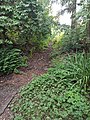
Moorgraben am RHB, northbound
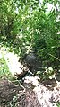
Moorgraben Fasanenstraße, shortly after the source

Moor trench on the Mühlenau road


Web links
Individual evidence
- ↑ Complete list of rivers in the Elbe catchment area. Retrieved June 30, 2020 .
- ↑ Moorgraben at OpenStreetMap. Accessed August 21, 2020 .