
Morozumi Range
| Morozumi Range | ||
|---|---|---|
| location | Victoria Land , East Antarctica | |
| part of | Usarp Mountains | |
|
||
| Coordinates | 71 ° 39 ′ S , 161 ° 55 ′ E | |

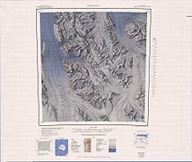
The Morozumi Range is an impressive range of the Usarp Mountains in northern Victoria Land . It extends for about 40 km in a north-west-south-east orientation and with its northern foothills towers over the place where the Gressitt glacier and the Rennick glacier flow together.
The geodetic survey was carried out by the United States Geological Survey and with the help of aerial photographs of the United States Navy from 1960 to 1963. The Advisory Committee on Antarctic Names named the mountain range in 1964 after the aurora scientist Henry M. Morozumi, who carried out field research on the Amundsen-Scott- South Pole Station and was scientific director of Byrd Station in 1963 .
Web links
- Morozumi Range in the Geographic Names Information System of the United States Geological Survey (English)
- Morozumi Range on geographic.org (English)

Northwest part of the Morozumi Range on the eastern edge of the map
Southeast part of the Morozumi Range on the western edge of the map

