Mount Beerwah
| Mount Beerwah | ||
|---|---|---|
|
Mount Beerwah viewed from the Mary Cairncross Reserve |
||
| height | 556 m | |
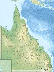
| location | Queensland , Australia | |
| Mountains | Glass House Mountains | |
| Coordinates | 26 ° 54 ′ 0 ″ S , 152 ° 53 ′ 0 ″ E | |
|
|
||
| rock | Rhyolite | |
| Age of the rock | 26 million years | |
| Last eruption | 26 million years | |
| First ascent | Andrew Petrie and John Petrie | |
|
Overhanging rock of the mountain with so-called organ pipes |
||
The Mount Beerwah is the highest of the twelve volcanic mountains in the Glass House Mountains , the 22 km north of Caboolture in the southeast of Queensland in Australia is. The mountain consists of rhyolite , a volcanic rock , and represents a volcanic column. It was formed 26 million years ago in the Tertiary and over time the rock around it weathered .
Description and dream time
The Mount Beerwah has two peaks, the greater is 556 m high. It is the most visited mountain in southeast Queensland.
In the Dreamtime of the Aborigines who was Mount Beerwah , the mother of the regional mountains, the Mount Tibrogargan the father and the other children their sons and daughters. The mountain name comes from the Aborigines of the Dungidau , from birra ( sky ) and wandum (to ascend ).
One side shows internal geological structures, the organ pipes (German: organ pipes ) are called. There are several small caves at the foot of the mountain.
Rockclimbing
Climbing Mount Beerwah is permitted and allows a wide panoramic view from the summit. The first white man to climb the mountain was Andrew Petrie with his son John.
A 2.6 km long path leads up the mountain from the state parking lot. The entry on the mountain has mountaineering difficulty levels and requires appropriate knowledge and skills, then the further path can be mastered without climbing aids.
Tourist information
A climb to the top of the mountain is not safe. Since January 2011, the ascent to Mount Beerwah has been blocked until further notice due to the risk of rockslides caused by heavy rainfall. There are other hiking trails in the vicinity of the mountain.
The parking lot near the mountain has picnic tables and toilets.
Web links
- kamil.dsplas.com : Photos from Mount Beerwah
Individual evidence
- ↑ summitpost.org : Tibrogargan , in English, accessed January 14, 2012
- ↑ arup.com.au ( Memento of August 21, 2011 in the Internet Archive ): APPENDIX C. Cultural Heritage Assessment , in English, accessed on January 14, 2012
- ^ A b Helen Horton: Brisbane's Back Door: The story of the D'Aguilar Range . Boolarong Publications, Bowen Hills, Queensland 1988, ISBN 086439036 X , pp. 142-144.
- ↑ Mount Beerwah Track . In: queenslandholidays.com.au . Tourism Queensland. Retrieved May 5, 2011.
- ↑ derm.qld.gov.au ( Memento of the original from September 3, 2012 in the Internet Archive ) Info: The archive link was inserted automatically and has not yet been checked. Please check the original and archive link according to the instructions and then remove this notice. : About Glass House Mountains , accessed January 14, 2012


