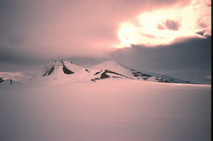
Mount Lepus
| Mount Lepus | ||
|---|---|---|
| height | 900 m | |
| location | Palmerland , Antarctic Peninsula | |
| Coordinates | 70 ° 39 ′ 51 ″ S , 67 ° 10 ′ 3 ″ W | |
|
|
||
Mount Lepus is a roughly 900 m high and subdivided massif by a deep saddle on the Rymill coast of the Palmerland on the Antarctic Peninsula . It rises 10 miles east of Wade Point between the Millett and Bertram glaciers .
The UK Antarctic Place-Names Committee named it in 1976 after the constellation Hare ( Latin Lepus ).
Web links
Commons : Mount Lepus - collection of images, videos and audio files
- Mount Lepus in the Geographic Names Information System of the United States Geological Survey (English)
- Mount Lepus on geographic.org (English)

