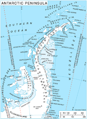
Palmerland
Palmerland is part of the Antarctic Peninsula that lies south of a line between Cape Jeremy and Cape Agassiz . North of this line is Grahamland .
Palmerland is named after the American explorer Nathaniel Palmer . The area is claimed by the three states of Great Britain , Argentina and Chile .
Southern border
![]() Map with all coordinates: OSM | WikiMap
Map with all coordinates: OSM | WikiMap
Until 2009, a line from Cape Adams at 75 ° 4 ′ S , 62 ° 20 ′ W (which roughly marks the edge of the Filchner-Ronne Ice Shelf ) to a point of the English- Coast viewed at 73 ° 24 ′ S , 72 ° 0 ′ W , facing the Eklund Islands . In 2009 the British redefined the southern border to take into account the knowledge gained since the middle of the 20th century about the coastline hidden by the ice shelf, from the Rydberg Peninsula at 73 ° 0 ′ S , 80 ° 0 ′ W to the grounding line of the Evans ice flow at approximately 76 ° 34 ′ S , 75 ° 0 ′ W , which also shifts the southern border of the Palmerland accordingly. As a result, geographical objects between the two southern borders are located in the Palmerland according to the British, while the US - which adheres to the conventional southern border - in Ellsworthland .
See also
- Argentine Antarctic Territory
- British Antarctic Territory
- Chilean Antarctic Territory
- Political status of the Antarctic
Individual evidence
- ↑ Palmer Land in the United States Geological Survey's Geographic Names Information System , accessed November 2, 2017
- ↑ a b c Palmer Land (GBR) in the SCAR Composite Gazetteer of Antarctica , accessed on November 2, 2017
- ↑ a b c Antarctic Peninsula (GBR) in the SCAR Composite Gazetteer of Antarctica , accessed on November 2, 2017
- ↑ a b c Antarctic Peninsula in the Geographic Names Information System of the United States Geological Survey , accessed November 2, 2017
Web links

