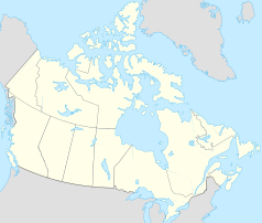
Mount Lorne (Yukon)
| Mount Lorne | ||
|---|---|---|
| Location in Yukon | ||
|
|
||
| State : |
|
|
| Territory : | Yukon | |
| Coordinates : | 60 ° 26 ′ N , 134 ° 54 ′ W | |
| Residents : | 370 (as of 2006) | |
Mount Lorne is a hamlet with 370 inhabitants (2006) in the Canadian Yukon . It is located south of Whitehorse and consists of several settlements along the southern Klondike Highway and its side roads.
55 inhabitants belong to the First Nations, mostly members of the Carcross / Tagish First Nation .
history
Early history
Artifacts were found at nearby Annie Lake in 1992, suggesting residents who lived here as early as 6000 BC. Lived. The predecessors of today's Carcross / Tagish First Nation lived as hunters, gatherers and fishermen in the border area between British Columbia and Yukon. When the first whites came to the region, they had their main camp on the Tagish River . There were two large clan houses there, similar to those of the Tlingit on the coast. With them they exchanged furs for mussels, the fat of candle fish , wooden boxes and seaweed long before the arrival of the Europeans . With these goods they traded east and south with neighboring tribes, about as far as the Ross River . The contact with the Tlingit became so intense that their cultures show great similarities. According to the extreme climate and the course of the year, they followed the game and the changing vegetation to get food.
Around 8000 BC Herds of caribou and bison lived in a park-like grassy landscape in the valleys of Watson and Wheaton. The melting glaciers and ice sheets of the last ice age left behind huge lakes and countless rivers. Few people lived here who left only two large lance tips on Annie Lake. On the other hand, there were hardly any fish in the landscape that was just released from the ice. Tiny blades known as microblades are characteristic of this era .
Around 4000 BC The area was covered by sand dunes, but a group of hunters left the remains of a fire that could be dated. The Northern Archaic culture produced an unusual spearhead here, first discovered at Annie Lake and known as Annie Lake Point .
Large forest fires after this epoch paved the way for erosion in places, and sand dunes piled up again. No human traces are detectable. Annie Lake was home to a hunting camp from which the men hunted sheep, caribou, and mountain goats. Around 500 AD the camp reached a high point of intensity of use, the climate was more humid, and the forest was denser. Possibly there was a sweat lodge there . Around 750 AD, a massive volcanic eruption occurred in the upper reaches of the White River , covering significant parts of the area with ash and forcing residents to flee. At Annie Lake, however, there was only a thin layer of ash that probably allowed it to stay, or at least to return a little later.
Web links
Remarks
- ^ Statistics Canada
- ↑ A description is provided by Désdélé Méné The Archeology of Annie Lake ( Memento of the original from February 12, 2009 in the Internet Archive ) Info: The archive link was automatically inserted and not yet checked. Please check the original and archive link according to the instructions and then remove this notice.
