Mykines (parish)
|
Mykines parish - Mycenae Δημοτική Ενότητα Μυκηναίων (Μυκήνες) |
||
|---|---|---|
|
|
||
| Basic data | ||
| State : |
|
|
| Region : |
Peloponnese
|
|
| Regional District : | Argolis | |
| Municipality : | Argos-Mycenae | |
| Geographic coordinates : | 37 ° 43 ' N , 22 ° 45' E | |
| Height above d. M .: | 218 m average |
|
| Area : | 150.033 km² | |
| Residents : | 3,388 (2011) | |
| Population density : | 22.6 inhabitants / km² | |
| Code No .: | 410207 | |
| Structure: | 7 local communities | |
| Website: | www.mikines.gov.gr | |
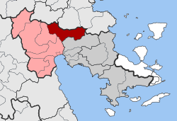
| Located in the Argos-Mycenae municipality and in the Argolis regional unit | ||
Mykines ( Greek Δημοτική Ενότητα Μυκηναίων , German also Mycenae ) has been a municipality in the municipality of Argos-Mycenae in the west of the Argolis since January 1, 2011 . Before the Kallikratis reform , Mykines 1997-2010 was an independent community around the actual village of Mykines , which was named in 1918 after the nearby excavation site of Mycenae .
Individual evidence
- ↑ Results of the 2011 census at the National Statistical Service of Greece (ΕΛ.ΣΤΑΤ) ( Memento from June 27, 2015 in the Internet Archive ) (Excel document, 2.6 MB)

