Argos-Mycenae
|
Argos-Mycenae municipality (Δήμος Άργους-Μυκηνών) |
||
|---|---|---|
|
|
||
| Basic data | ||
| State : |
|
|
| Region : | Peloponnese | |
| Regional District : | Argolis | |
| Geographic coordinates : | 37 ° 39 ′ N , 22 ° 44 ′ E | |
| Area : | 1,002.6 km² | |
| Residents : | 42,022 (2011) | |
| Population density : | 41.9 inhabitants / km² | |
| Community logo: | ||
| Seat: | Argos | |
| LAU-1 code no .: | 4102 | |
| Districts : | 8 municipal districts | |
| Local self-government : |
3 city districts 35 local communities |
|
| Website: | www.argos.gr | |
| Location in the Peloponnese region | ||


The Greek community Argos-Mykene ( Greek Άργος-Μυκήνες Argos-Mykines , pronunciation : [ ˈarɣɔs miˈkʲinɛs ]) was formed on January 1, 2011 from the merger of eight communities in the west of the Argolis . Some of the most important archaeological sites of ancient Greece, such as Mycenae and Lerna, are located on their territory . The center and administrative seat of the municipality is presumably the oldest permanently populated city in Europe, Argos .
geography
Argos-Mycenae covers most of the plain of the Inachos River , which flows entirely in the territory of the municipality and flows into the Argolic Gulf in the south , on whose northwestern branch the municipality borders. To the west, the area rises initially hilly, then mountainous and finds its border with the ridge of a mountain range to the municipality of Tripoli in Arcadia . The names of the peaks are (from north to south) Oligyrtos ( 1935 m ), Lyrkio ( 1746 m ), Artemisio ( 1771 m ), Ktenias ( 1958 m ) and Parthenio ( 1215 m ). The Farmakas ( 1616 m ) in the northeast of the municipality forms the watershed between the catchment area of the Inachos and the system of Lake Stymfalia in the municipality of Sikyona . Less prominent and lower mountains also demarcate the municipality to the north to the municipalities of Nemea and Corinth , the western neighboring town in the plain is Nafplio . To the south, the Arcadian community of Voria Kynouria borders Argos-Mycenae.
history
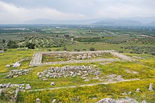
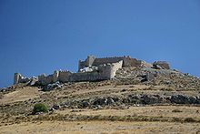
The municipality is one of the centers of the Mycenaean culture of the second millennium BC. Traces of settlement of the Neolithic from the third millennium BC BC can be found in the Lerna excavation site . The remains of Heraion of Argos and the ancient relics of the city of Argos have been preserved from the archaic and classical times of ancient Greece .
Shortly after the founding of modern Greece, the province of Argos (gr. .ΠαρΕα Άργους, Eparchia Argous ) was formed in 1833 , at that time in the prefecture of Argolis-Korinthia, which corresponded to today's municipality. In 1997, the numerous municipalities in the area were grouped into eight larger municipalities in the now independent Argolis Prefecture and the provinces were abolished as a regional body. With the administrative reform of 2010 , the prefectures were abolished and the municipality of Argos-Mycenae was established in the area. The eight predecessor municipalities continue to exist as municipal districts ( Ez.gr.dimotiki enotita ), the municipalities from before 1997 form urban districts ( Ez.gr.dimotiki kinotita, for places with more than 2000 inhabitants) or local communities ( Ez.topiki kinotita ), their own local representatives choose.
politics
Argos-Mycenae is governed by a 31-member municipal council. Dimitrios Panagiotis Kambosos ( Nea Dimokratia ) has been mayor since the elections in November 2010 , and his list has 25 seats on the local council. An alliance of PASOK , ecologists / Greens and the Democratic Left won 13 seats, 2 seats were occupied by a free electoral alliance, and the representative of the KKE won one seat .
Community structure
The population figures come from the results of the 2011 census.
- District Achladokambos - Δημοτική Ενότητα Αχλαδοκάμπου - 497
- Local community Achladokambos - Τοπική Κοινότητα Αχλαδοκάμπου - (Αχλα)
- Alea Parish - Δημοτική Ενότητα Αλέας - 660
- Local community Agios Nikolaos - Τοπική Κοινότητα Αγίου Νικολάου - 140
- Agios Nikolaos - Άγιος Νικόλαος - 7
- Exochi - Εξοχή - 30
- Platani - Πλατάνι - 103
- Local community Alea - Τοπική Κοινότητα Αλέας (Αλέα) - 103
- Local community Frousiouna - Τοπική Κοινότητα Φρουσιούνας (Φρουσιούνα) - 70
- Local community Skotini - Τοπική Κοινότητα Σκοτεινής (Σκοτεινή) - 347
- Local community Agios Nikolaos - Τοπική Κοινότητα Αγίου Νικολάου - 140
- Argos Municipality - Δημοτική Ενότητα Άργους - 27,050
- Argos District - Δημοτική Κοινότητα Άργους - 22.602
- Akova - Άκοβα - 167
- Argos - Άργος - 22.209
- Kokla - Κόκλα - 153
- Timeni - Τημένι - 73
- Local community Dalamanara - Τοπική Κοινότητα Δαλαμανάρας (Δαλαμανάρα) - 877
- Local community Elliniko - Τοπική Κοινότητα Ελληνικού (Κρυονερίου) - 410
- Elliniko - Ελληνικό - 378
- Krya Vrysi - Κρύα Βρύση - 12
- Kryoneri - Κρυονέρι - uninhabited
- Tourniki - Τουρνίκι - 3
- Zonga - Ζόγκα - 17th
- Local community Ira - Τοπική Κοινότητα Ήρας (Ήρα) - 369
- Local community Inachus - Τοπική Κοινότητα Ινάχου - 738
- Inachus - Ίναχος - 622
- Tristrato - Τρίστρατο - 116
- Local community Kefalari - Τοπική Κοινότητα Κεφαλαρίου - 800
- Kefalari - Κεφαλάρι - 677
- Magoula - Μαγούλα - 123
- Local community Kourtaki - Τοπική Κοινότητα Κουρτακίου (Κουρτάκι) - 296
- Local community Laloukas - Τοπική Κοινότητα Λάλουκα (Λάλουκας) - 540
- Local community Pyrgella - Τοπική Κοινότητα Πυργέλλας (Πυργέλλα) - 418
- Argos District - Δημοτική Κοινότητα Άργους - 22.602
- Koutsopodi municipality - Δημοτική Ενότητα Κουτσοποδίου - 3,272
- District of Koutsopodi - Δημοτική Κοινότητα Κουτσοποδίου - 2.177
- Agia Ekaterini - Αγία Αικατερίνη - 49
- Airfield - Αεροδρόμιο - 111
- Koutsopodi - Κουτσοπόδι - 1,857
- Panorama - Πανόραμα - 137
- Synoro - Σύνορο - 23
- Local community Vrousti - Τοπική Κοινότητα Βρουστίου - 292
- Statheika - Σταθαίικα - 240
- Vrousti - Βρούστι - 19
- Chandakia - Χαντάκια - 33
- Local community Maladreni - Τοπική Κοινότητα Μαλαντρενίου (το Μαλαντρένι) - 498
- Local community Schinochori - Τοπική Κοινότητα Σχινοχωρίου - 305
- Chelmis - Χέλμης - uninhabited
- Shinochori - Σχινοχώρι - 305
- District of Koutsopodi - Δημοτική Κοινότητα Κουτσοποδίου - 2.177
- Lerna municipality - Δημοτική Ενότητα Λέρνας - 2,319
- Local community Andritsa - Τοπική Κοινότητα Ανδρίτσης (Ανδρίτσα) - 33
- Local community Kiveri - Τοπική Κοινότητα Κιβερίου - 1.029
- Kiveri - Κιβέρι - 911
- Spiliotakis - Σπηλιωτάκης - 39
- Velanidia - Βελανιδιά - 79
- Local community Myli - Τοπική Κοινότητα Μύλων - 741
- Kalamaki - Καλαμάκι - 100
- Kougeika - Κουγαίικα - 31
- Myli - Μύλοι - 610
- Local community Skafidaki - Τοπική Κοινότητα Σκαφιδακίου - 516
- Almyros - Αλμυρός - 11
- Dichalia - Διχάλια - 67
- Skafidaki - Σκαφιδάκι - 438
- Lyrkia parish - Δημοτική Ενότητα Λυρκείας - 2.058
- Local community Frengena - Τοπική Κοινότητα Φρεγκαίνης - 128
- Agios Stefanos - Άγιος Στέφανος - 12
- Merkouri - Μερκούρι - 58
- Frengena - Φραίγκενα - 58
- Local community Gymno - Τοπική Κοινότητα Γυμνού - 319
- Gymno - Γυμνό - 306
- Tsiristra - Τσιρίστρα - 13
- Local community Kaparelli - Τοπική Κοινότητα Καπαρελλίου (Καπαρέλλι) - 299
- Local community Karya - Τοπική Κοινότητα Καρυάς - 676
- Agios Georgios - Άγιος Γεώργιος - 14
- Agrilitsa - Αγριλίτσα - 149
- Aria - Αρία - 13
- Bozioneleika - Μποζιονελαίικα - 39
- Chouni - Χούνη - 124
- Galaneika - Γαλαναίικα - 25
- Galati - Γαλάτι - 43
- Karya - Καρυά - 165
- Spaneika - Σπαναίικα - 85
- Stravi Rachi - Στραβή Ράχη - 19
- Local community Kefalovryso - Τοπική Κοινότητα Κεφαλοβρύσου - 129
- Kefalovryso - Κεφαλόβρυσο - 53
- Douka Vrysi - Δούκα Βρύση - 76
- Local community Lyrkia - Τοπική Κοινότητα Λυρκείας (Λύρκεια) - 319
- Local community Neochori - Τοπική Κοινότητα Νεοχωρίου (το Νεοχώρι) - 63
- Local community Sterna - Τοπική Κοινότητα Στέρνας (Στέρνα) - 125
- Local community Frengena - Τοπική Κοινότητα Φρεγκαίνης - 128
-
Mykines parish - Δημοτική Ενότητα Μυκηναίων - 3,388
- Local community Borsas - Τοπική Κοινότητα Μπόρσα (Μπόρσας) - 186
- Local community Fichti - Τοπική Κοινότητα Φιχτίου (Φίχτι) - 761
- Local community Limnes - Τοπική Κοινότητα Λιμνών (Λίμνες) - 734
- Local community Monastiraki - Τοπική Κοινότητα Μοναστηρακίου (Μοναστηράκι) - 276
- Local community Mykines - Τοπική Κοινότητα Μυκηνών (Μυκήνες) - 354
- Local community Neo Ireo, formerly Chonikas - Τοπική Κοινότητα Νέου Ηραίου / Χώνικα (Νέο Ηραίο / Χώνικας) - 488
- Local community Prosymna - Τοπική Κοινότητα Προσύμνης (Πρόσυμνα) - 589
- Parish of Nea Kios - Δημοτική Ενότητα Νέας Κίου - 2,778
- Municipality of Nea Kios - Δημοτική Κοινότητα Νέας Κίου (Νέα Κίος) - 2,778
traffic
A section of the A 7 runs through the northeastern municipality , which connects the municipality with Corinth and Attica . The old national road 7 opens up the municipality from the north, divides at Mycenae into a path that leads to Nafplio on the eastern edge of the Inachos plain, and into the road to Argos. From Argos you can reach Arcadia via Nea Kios further south along the coast, a pass road branches off in the south to the west via Myli and Achladokambos to Tripoli.
Shipping traffic is handled via the port of nearby Nafplio. The eastern Peloponnese does not have an airport. The already insignificant railway traffic over a branch line of the Corinth-Tripoli line via Argos to Nafplio was discontinued in 2011.
Individual evidence
- ↑ a b Results of the 2011 census. ( Memento from June 27, 2015 in the Internet Archive ) ( MS Excel ; 2.6 MB) National Statistical Service of Greece (ΕΛ.ΣΤΑΤ)
- ↑ Greek Law Gazette No. 1292 of August 11, 2010 (PDF, 555 kB)


