NAVTEX
NAVTEX ("NAVigational TEXt Messages" - formerly also known as "NAVigational Warnings by TEleX") is used in shipping worldwide to distribute safety and weather information (Maritime Safety Information) and is a part of the global Global Maritime Distress and Safety System (GMDSS ).
Messages are broadcast with the error-correcting radio teletype system SITOR -B on the frequency 518 kHz in English and in some countries also on the frequencies 490 kHz and 4209.5 kHz in the national language. Japanese and Chinese stations transmit NAVTEX messages in Japanese and Chinese on the national frequencies 424 kHz and 486 kHz.
history
Before the introduction of the NAVTEX system, weather and navigation warnings were received at sea mostly via voice transmissions from coastal radio stations at set times. The messages were received and recorded manually so that the time to listen to a broadcast could easily be missed. Technology was therefore developed to be able to transmit weather and navigation warnings in writing to automatically working receivers.
In 1977 a NAVTEX installation was first tested in Sweden. Shortly afterwards, in 1979, residents of the Baltic Sea started operating the NAVAREA 1, the first NAVTEX network. With Resolution A.617 (15) from 1987, NAVTEX became part of the GMDSS. NAVTEX receiver equipment has been mandatory for ships over 300 tons GT and passenger ships since 1993 . NAVTEX receivers are nowadays compact and inexpensive and can often be found on boats and ships that do not require equipment.
For the transmission of information, the world is divided into 21 “Navareas” (internationally defined sea warning areas). In the Navareas, the individual transmitters are designated with letters from A to Z (in the northern hemisphere from north to south). Stations in an area send one after the other to avoid mutual interference. The range is up to 600 nautical miles. The NAVTEX stations are coordinated by the International Maritime Organization .
- See table: Navtex stations
- There is also a world map with the Navareas. The NAVTEX stations are recorded with their identification, exact position, frequencies, transmission times and ranges, sorted according to Navareas.
On August 29, 2006, the German Weather Service officially put a new NAVTEX transmitter in the Pinneberg transmitter into operation. Pinneberg is the only German station and supplies the entire German coast and parts of the North and Baltic Seas. Messages for the German Baltic Sea areas in English are sent out by the station Gislövshammar near the Swedish town of Skillinge .
Set stations
All stations appear in the display of a NAVTEX receiver as code letters A to Z. Each station can be deselected and an individual selection can be made, e.g. For example: "AbcdefGHIijklmnopqrStuvwXYZ" (uppercase letter = on, lowercase letter = off).
Set message types
| A. | Navigation warnings |
| B. | Meteorological warnings |
| C. | Ice reports |
| D. | SAR reports |
| E. | Weather forecasts |
| F. | Pilot information |
| G | AIS information (formerly Decca warnings) |
| H | LORAN warnings |
| I. | OMEGA warnings |
| J | Satellite navigation warnings, e.g. B. GPS warnings |
| K | Warnings for other electronic navigation systems |
| L. | further navigation warnings |
| V to Y | Special services |
| Z | There are no reports |
All message types are transmitted one after the other. All message types appear in the display as identification letters A to Z. Each message type can be deselected and an individual selection can be made, e.g. E.g .: "ABcDEfghijkLmnopqrstuvwxyz" (uppercase letter = on, lowercase letter = off). A, B, D and L are always output. E (weather forecast) is also one of the indispensable data.
Structure of a NAVTEX message
The structure of the message can differ in detail from the example below. The first and last lines are always structured in the same way.
| report | Explanation |
|---|---|
|
ZCZC PA09 NETHERLANDS COASTGUARD NAVIGATIONAL WARNING NO. 9 172128 UTC AUG PLATFORM L10-G 53-29.4N 004-11.7E UNLIT NNNN |
Every NAVTEX message begins with the letters ZCZC . This is followed by the message identifier (PA09) . In this case it is NETHERLANDS COASTGUARD (P). The type of message is encoded in the second letter, here NAVIGATIONAL WARNING (navigation warnings ). The last two digits of the message identifier (09) are a sequential number. The number 00 has a special position. It is reserved for distress reports. NAVTEX messages have a time stamp. It can be seen at the end of the third line (172128 UTC AUG) and means: August 17th, 21:28 UTC. The timestamp refers to the date the message was created, not the time it was broadcast. This is followed by the message content, here a message about an obstacle with defective lighting. The message is terminated with NNNN . |
Weather forecast
| report | Explanation |
|---|---|
ZCZC JE92 Error Rate= 0,0 % 170500 UTC MAY SWEDISH WEATHER SHIPPING WEATHER SUMMARY FROM HIGH IN GREENLAND RIDGE OF HIGH SOUTHEASTWARDS TO SWEDEN, WEAK AREA OF LOW OVER WEST_EUROPE: LOW NORTHWEST OF LOFOTEN ISLANDS LATER TODAY DEEPENING. GALEWARNINGS NIL FORECAST VALID 24 HOURS SKAGERRAK; KATTEGAT; THE SOUND: AROUND EAST 3-7 M/S SOMEWHAT INCREASING; IN WESTERN PART OF SKAGERRAK DURING DAY AROUND 10. MAINLY GOOD VIS, IN SKAGERRAK AT TIMES SOME RAIN. THE BELTS; WESTERN BALTIC: Belt, EASTERLY 7-11. GOOD VIS. NNNN |
Beginnzeichen, Sender/Art/Laufnummer und Fehlerrate 17ter um 0500 UTC, Mai schwedische Seewettervorhersage Wetterlage Vom Hoch über Grönland Hochdruckbrücke Richtung Südost bis Schweden, schwaches Tief über Westeuropa: Tief nordwestlich der Lofoten, später am Tag vertiefend. Sturmwarnungen keine (wörtlich "nichts") Vorhersage gültig für 24 Stunden Skagerrak; Kattegat; Sund: Winde um Ost 3–7 m/s, etwas zunehmend; im westlichen Teil des Skagerrak während des Tages um 10 überwiegend gute Sicht, Skagerrak zeitweise etwas Regen. Belte; westliche Ostsee: Belt, östliche Winde 7–11 (kn, da ohne m/s), gute Sicht |
Meteorological expressions
Internationally defined technical terms are used in NAVTEX messages for better understanding. See the list of meteorological expressions in German, English, Spanish and French.
technology
NAVTEX transmitters transmit messages using the SITOR -B method in the medium wave transmission range on 518 kHz in English and on 490 kHz in the respective national language. For areas in which the medium wave is impaired by atmospheric disturbances, the short wave frequency 4209.5 kHz can be used. A 100 baud frequency shift (FSK modulation) with a frequency shift of 170 Hz is used for transmission .
NAVTEX stations transmit in a 4-hour cycle in ten-minute time windows. Due to the time offset achieved, several stations can use the same frequency without mutual interference, with the exception of emergency messages, which are sent immediately. The transmission power of the stations is limited to a necessary minimum, so that there is no interference between simultaneously transmitting stations from different Navareas, especially at night.
The transmission range of NAVTEX stations is usually 100-500 nautical miles around the station. With favorable meteorological conditions it is also possible to receive from much larger distances.
equipment
- Permanently installed receiving stations
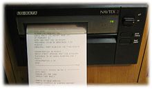
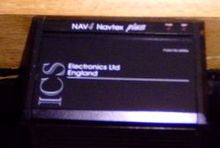
- Permanently installed receiving stations usually consist of an active antenna and a receiver with an output device. Receivers from the companies ICS, Fastnet, Nasa and Furuno with an integrated display and / or printer (with an integrated roll of paper) are widespread .
- Black box receiver
- Black box receivers are also common . These are available in versions with both an external and an integrated antenna. Black box receivers are connected to a PC or notebook via cables. The data received is displayed on the screen, which can then be used to conveniently display and manage the data.
- Portable Navtex receivers
- Since 2007 the company Mörer Schiffselektronik has been offering portable Navtex receivers which, thanks to an integrated ferrite rod antenna and an LCD screen in the device, work without a connection to a PC or notebook and without an external antenna. The data received is shown on the integrated LC display. All messages are automatically managed on the device and sorted according to message type and time of receipt (see "Setting message types", see above). In addition, the devices can be connected to a PC or notebook via USB and the data can be displayed on the computer screen.
- Radio sets with medium wave SSB reception
- So-called "world receivers" with a frequency range that covers 518 kHz and allows the selection of the upper sideband can be connected to a PC or notebook via a simple audio cable.
On the computer, software such as B. the freely available program YAND (Yet Another Navtex Decoder) or the chargeable SeaTTY a Navtex receiver with a considerable range of functions can be implemented. The advantage of this solution is that all other receivable programs and frequencies can be heard on the radio and the purchase is significantly cheaper than buying a special device.
NAVTEX decoder
- Bonito MeteoCom, international MeteoServer
- SeaTTY (PC / commercial)
- Frisnit Navtex Decoder (PC / Mac (Java) / free)
- Winradio (PC / commercial)
- MultiMode (Mac / Commercial)
- JVComm32 (PC / Shareware)
- JNX (PC / Mac (Java) / Free (GPL))
Examples of the NAVTEX displays
NAVTEX messages via the Internet
Some organizations feed NAVTEX messages onto the Internet so that they can be accessed worldwide with a browser ; The operators do not guarantee the reliability of the NAVTEX messages distributed over the Internet, so this information may not be used without being checked for safety-related decisions:
- German weather service with the 490 kHz and 518 kHz NAVTEX messages, received in Emden and Rostock
- Greece Meteorological Service (Hellenic National Meteorological Service HNMS) ( Maritime Bulletin )
- JCOMM (marine weather information broadcast via Inmarsat-C SafetyNET, weather.gmdss.org) Official website of the Inmarsat-C SafetyNET marine weather services
- Worldwide live reception of NAVTEX news (frisnit.com)
See also
Individual evidence
- ↑ a b c d e Implementation of the NAVTEX System as a Component of the World-wide Navigational Warning Service. (pdf) International Maritime Organization , November 19, 1987, accessed on September 1, 2019 (English).
- ↑ a b Revised NAVTEX Manual. (pdf) International Maritime Organization , May 23, 2011, accessed on September 1, 2019 (English).
- ↑ Master Plan of Shore-based Facilities for the Global Marine Distress and Safety System (GMDSS Master Plan). (pdf) Annex 7, NAVTEX Service. International Maritime Organization , July 30, 2018, accessed on August 31, 2019 .
- ↑ a b Focus on IMO - Shipping Emergencies - Search and Rescue and the GMDSS. (pdf) The components of the GMDSS - NAVTEX. International Maritime Organization , March 1999, accessed on September 1, 2019 .
- ↑ Wolfgang Seifert: Establishment of a NAVTEX broadcasting operation at the weather radio transmission system of the DWD in Pinneberg . In: Mitteilungen DMG - the official organ of the German Meteoreological Society . 4, 2006, pp. 6-7.
- ↑ Navtex for shipping. German Weather Service , accessed on August 29, 2019 .
- ^ A b Amendments to the Revised NAVTEX Manual. (pdf) Annex II, 2.1.2 along with note 16. International Maritime Organization , November 25, 2016, accessed on September 1, 2019 (English).
- ↑ DX Radio UK, Navtex Reception
- ↑ Weatherinfobox WIB2D


