
Nakagyō-ku (Kyoto)
|
Municipality of Kyoto |
|
|---|---|
  |
|
| Coordinates | 35 ° 0 ′ 36 " N , 135 ° 45 ′ 6" E |
| surface | 7.38 km² |
| Residents | 110,821 (Oct. 1, 2019) |
| Population density | 15,016 inhabitants / km² |
| Start-up | Apr 1, 1929 |
| Community key | 26104-1 |
Administration address |
521, Nishihorikawa-dōri Oike sagaru, Nishisanbōhorikawachō, Nakagyō-ku, Kyōto 604-8588 |
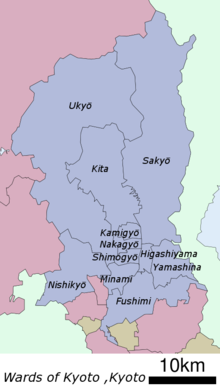
Nakagyō-ku ( Japanese 中 京 区 , German "Central Capital District") is one of eleven districts ( ku ) of Kyōto , Japan .
history
The municipality was created on April 1, 1929 from the union of the southern part of Kamigyō-ku with the northern part of Shimogyō-ku .
geography
As an inner city district, it is the center of administration, consumption, tourism and entertainment in Kyoto. In the east, the Kamo crosses the district. Kawaramachistraße runs parallel to it, at the intersection of which with Shijostraße is the city's main shopping district.
Attractions

The three most famous festivals of Kyoto, the Aoi-Matsuri , the Gion-Matsuri and the Jidai-Matsuri take place in Nakagyō-ku. The district is home to numerous historical sites, temples and museums, including the Nijō-jō Castle (a former residence of the Tokugawa shogunate ) and the Kyoto International Manga Museum .
The Rokkaku-do temple was rebuilt in 1877 after a fire.
Web links
- official website (Japanese)
Fushimi-ku | Higashiyama-ku | Kamigyō-ku | Kita-ku | Minami-ku | Nakagyō-ku | Nishikyō-ku | Sakyō-ku | Shimogyō-ku | Ukyō-ku | Yamashina-ku