
Nishikyō-ku (Kyōto)
|
Municipality of Kyoto |
|
|---|---|
  |
|
| Coordinates | 34 ° 59 '6 " N , 135 ° 41' 36" E |
| surface | 59.20 km² |
| Residents | 148,970 (Oct 1, 2019) |
| Population density | 2516 inhabitants / km² |
| Start-up | Oct. 1, 1976 |
| Community key | 26111-4 |
Administration address |
25-1, Kamikatsura-Morishitachō, Nishikyō-ku, Kyōto 615-8522 |
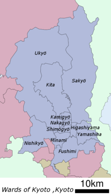
Nishikyō-ku ( Japanese 西京 区 , German "western capital district") is one of eleven city districts ( ku ) of Kyōto , Japan . According to its name, it is located on the western edge of the city, south of the city center.
history
The municipality was created on October 1, 1976 from the spin-off of the districts Matsuo, Katsura, Kawaoka, Ōe and Ōharano from Ukyō-ku . The Katsura River forms the border between the two districts.
Attractions

Located over the river, the Katsura Imperial Villa is one of Nishikyō-ku's most famous landmarks. The Saihō-ji moss temple, which is also located in the district, is a UNESCO World Heritage Site . The Yoshimine-dera is another Buddhist temple.
Web links
- official website (Japanese)
Fushimi-ku | Higashiyama-ku | Kamigyō-ku | Kita-ku | Minami-ku | Nakagyō-ku | Nishikyō-ku | Sakyō-ku | Shimogyō-ku | Ukyō-ku | Yamashina-ku