Namakan Lake
| Namakan Lake | ||
|---|---|---|
| Geographical location |
Ontario (Canada), Minnesota (USA) |
|
| Tributaries |
Namakan River , from Kabetogama Lake , from Sand Point Lake |
|
| Drain | to Rainy Lake | |
| Islands | Blackstone Island, Moose Island | |
| Location close to the shore | Ray | |
| Data | ||
| Coordinates | 48 ° 27 ′ N , 92 ° 35 ′ W | |
|
|
||
| Altitude above sea level | 339 m | |
| surface | 97.4 km² | |
| Maximum depth | 45 m | |
|
particularities |
flow regulated |
|
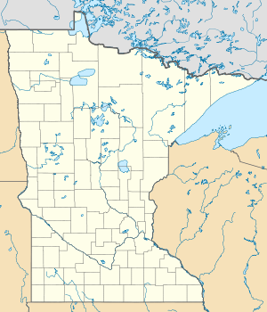
The Namakan Lake is a lake on the border between the United States and Canada .
Namakan Lake is within the Voyageurs National Park . It has an area of 97.4 km². The outflow of Namakan Lake via two arms north and south of Kettle Island into Rainy Lake to the north is regulated.
Because of this flow regulation, Namakan Lake is part of the so-called Namakan Reservoir , which also includes the following lakes: Crane Lake , Kabetogama Lake , Little Vermilion Lake and Sand Point Lake . Important tributaries are the Namakan River and the Vermilion River , which flows into Namakan Lake via the southern lakes Crane Lake and Sand Point Lake. To the west, the Kabetogama Lake borders the Namakan Lake.
Namakan Lake is a popular destination for amateur fishermen. The following types of fish are caught in the lake: eyeglasses , pike , black bass , Canadian pikeperch and black crappie .
Web links
Individual evidence
- ↑ a b Minnesota Dept. of Natural Resources
- ↑ a b www.fishingontario.org ( Memento of the original from June 8, 2013 in the Internet Archive ) Info: The archive link was inserted automatically and has not yet been checked. Please check the original and archive link according to the instructions and then remove this notice.
