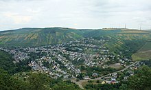
Naumeter head
| Naumeter head | ||
|---|---|---|
| height | 343.9 m above sea level NHN | |
| location | Rhineland-Palatinate , Germany | |
| Coordinates | 49 ° 44 ′ 17 " N , 6 ° 44 ′ 13" E | |
|
|
||
The Naumeter Kopf near Trier is a mountain between Korlingen , Trier-Tarforst and Waldrach / Ruwertal . It has a height of 343.9 m above sea level. NHN and is marked with a summit cross .
On the Naumeter head, also called Naumeter Kupp, there was a refuge .
From Waldrach the hiking trail RT 1 (formerly: Förster-Mende-path ) leads about 170 meters in altitude to Naumeter Kupp. In the system of dream loops on the Saar-Hunsrück-Steig , the Trier gallows head tour also leads there.
Web links
Commons : Naumeter Head - Collection of Images
- To search for cultural assets: Naumeter Kopf in the database of cultural assets in the Trier region .


