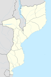
Nhamatanda
| Nhamatanda | ||
|---|---|---|
|
|
||
| Coordinates | 19 ° 16 ′ S , 34 ° 13 ′ E | |
| Basic data | ||
| Country | Mozambique | |
| Sofala | ||
| District | Nhamatanda | |
| ISO 3166-2 | MZ-S | |
| height | 64 m | |
| Residents | 20,000 | |
Nhamatanda (formerly Vila Machado , English Bambu Creek ) is a city in the Mozambican province of Sofala .
geography
Nhamatanda is the capital of the Nhamatanda district and is on the railway line from the provincial capital Beira to Harare , the capital of Zimbabwe . Beira is 92 kilometers southeast of Nhamatanda. The altitude is 64 m .
population
The city has a good 20,000 inhabitants. They mainly speak Chisena .
history
Nhamatanda was founded by the Portuguese in 1898 , then under the name Nova Fontesvila after Marquis Fontes Pereira de Melo . In the 1920s, the city was renamed Vila Machado, after Joaquim José Machado , the governor of Mozambique from 1890 to 1925. In 1975, after Mozambique gained independence, the city was given its current name after the nearby river of the same name .
Web links
Individual evidence
- ↑ Tixik ( Memento of the original from July 26, 2010 in the Internet Archive ) Info: The archive link was inserted automatically and has not yet been checked. Please check the original and archive link according to the instructions and then remove this notice. (dead link)
- ↑ Vila Machado ( Memento of the original from January 5, 2010 in the Internet Archive ) Info: The archive link was inserted automatically and has not yet been checked. Please check the original and archive link according to the instructions and then remove this notice. (dead link)

