Nielsen Fjord
| Nielsen Fjord | ||
|---|---|---|
|
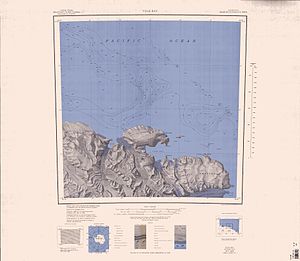
Topographic map with the Nielsen Fjord (left of center) |
||
| Waters | Somow lake | |
| Land mass | Victoria Land , East Antarctica | |
| Geographical location | 70 ° 42 ′ 0 ″ S , 165 ° 50 ′ 0 ″ E | |
|
|
||
| width | approx. 4 km | |
| Tributaries | McMahon Glacier | |
The Nielsen Fjord is a 4 km wide fjord on the Pennell coast in the north of the East Antarctic Victoria Land . It is between Cape North and the Gregory Bluffs .
It was named after Captain Hans Nielsen, skipper of the Thala Dan for coastal surveying in 1962 , during the Australian National Antarctic Research Expeditions .
Web links
- Nielsen Fjord in the Geographic Names Information System of the United States Geological Survey (English)
- Nielsen Fjord on geographic.org (English)

