
Nowohryhoriwka (Mykolaiv)
| Novohryhorivka | |||
| Новогригорівка | |||

|
|
||
| Basic data | |||
|---|---|---|---|
| Oblast : | Mykolaiv Oblast | ||
| Rajon : | Mykolaiv Raion | ||
| Height : | 41 m | ||
| Area : | Information is missing | ||
| Residents : | 199 (2015) | ||
| Postcodes : | 57121 | ||
| Area code : | +380 512 | ||
| Geographic location : | 47 ° 7 ' N , 31 ° 46' E | ||
| KOATUU : | 5123582803 | ||
| Administrative structure : | 1 village | ||
| Address: | вул. Андрія Шептицького буд. 9 57116 с. Михайлівка |
||
| Website : | Official website of the rural community | ||
| Statistical information | |||
|
|||


Novohryhoriwka ( Ukrainian Новогригорівка ; Russian Новогригоровка Novogrigorowka ) is a village in the Ukrainian Oblast of Mykolaiv with about 200 inhabitants (2015).

history
The village was first mentioned in 1767 on a map by the Italian cartographer Giovanni Antonio Rizzi Zannoni (1736-1814) in writing as Tschubowke ( Чубовке ). In the 19th century the village changed its name to Novohryhorivka. The population of the village was in 1858 a total of 271 people, including 136 men and 137 women. During the Romanian occupation (the village was in the Romanian-occupied region of Transnistria Governorate during the Second World War ), the village was connected to the newly built narrow-gauge railway Varvarovca ( Варварівка Warwariwka , today a district of Mykolaiv ( Варварівка Warwariwka ) on the right bank of the Bugschatyiv ( Mykolaiv) -Novohryhoriv Трихати ) connected and provided with a train station. The railway was in operation until the early 1990s.
Geographical location
Nowohryhoriwka has administratively belonged to the rural municipality of Michailіwka in the north of Mykolaiv Raion since 2019 .
The location situated at an altitude of 41 m at the bank of the stream Solonycha ( Солониха ), 13 km south-east of the community center Michailіwka ( Михайлівка ), and 28 km northwest of the Rajon- and Oblastzentrum Mykolajiw .
The territorial road T – 15–06 runs six kilometers west of the village .

Village street
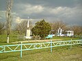
War memorial

Village school

graveyard


Web links
- Village website (Ukrainian)
Individual evidence
- ^ Community structure on the official website of the rural community; accessed on June 23, 2020 (Ukrainian)
- ↑ local history Nowohryhoriwka on kraeved.od.ua ; accessed on June 23, 2020 (Ukrainian)
- ↑ a b Novohryhoriwka on bazar.nikolaev.ua ; accessed on June 23, 2020 (Ukrainian)