Oelingrath
|
Oelingrath
City of Remscheid
Coordinates: 51 ° 12 ′ 38 " N , 7 ° 11 ′ 35" E
|
||
|---|---|---|
| Height : | 282 m above sea level NN | |
| Postal code : | 42855 | |
| Area code : | 0202 | |
|
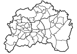
Location of Oelingrath in Remscheid |
||
Oelingrath is a town in the north of the Bergisch city of Remscheid (district Lüttringhausen ) in North Rhine-Westphalia / Germany near the city limits of Wuppertal - Ronsdorf .
,
Location and description
Today it is directly connected to the locality of Langenhaus and lies at an altitude of 282 meters above sea level . The road in a southerly direction leads to the Grund and on to the Morsbachtal. In Oelingrath there are 34 residential buildings, some partly very old, slated half-timbered houses and otherwise all new buildings in a new cul-de-sac. Even if the courtship has a rural appearance due to the old farmhouses, agriculture no longer plays a role here today.
The Oelingrath Bach , which flows into the Grunder Bach to the south near the village of Grund , has its source near Oelingrath , a tributary of the Morsbach .
history
The place was first mentioned in 1471. In the Topographia Ducatus Montani by Erich Philipp Ploennies from 1715 it is recorded as "Ulingradt". This map series also shows an old coal road that ran east of the village through the Neuland area and connected the southern Ruhr area with Remscheid. It was used in particular to transport coal to the metalworking companies in the Morsbachtal and in the Remscheid area. In places this road has developed into a ravine over the centuries , which in 2009 was designated as a ground monument in this section .
Monuments
Over the centuries , the coal road has developed into a ravine that was designated as a ground monument in this section in 2009 . The houses Oelingrath 2 and 3 are on the municipal monuments list.
Infrastructure
By Long House / Oelingrath in run public transport rather sporadically a city bus and several times a day a citizen bus . Several local hiking trails can be found nearby.
To the east of Oelingrath is the burial forest "Im Kempkenholz".
Individual evidence
- ^ Klaus-Günther Conrads, Günter Konrad: Ronsdorfer Heimat- und Bürgererverein | from 1246 to 1699. In: ronsdorfer-buergerverein.de. www.ronsdorfer-buergerverein.de, accessed on February 1, 2016 .
- ↑ Westdeutsche Zeitung
- ↑ Westdeutsche Zeitung
-
↑ Burial Forest Im Kempkenholz ( memento from December 19, 2010 in the Internet Archive ) on the website of the City of Remscheid
Burial Forest Im Kempkenholz ( memento of the original from April 29, 2013 in the Internet Archive ) Info: The archive link was inserted automatically and has not yet been checked. Please check the original and archive link according to the instructions and then remove this notice. on the website of the city of Remscheid, seen April 12, 2013


