Old Mission Peninsula
| Old Mission Peninsula | ||
 View from the peninsula to Marion Island |
||
| Geographical location | ||
|
|
||
| Coordinates | 44 ° 53 ′ N , 85 ° 32 ′ W | |
| Waters 1 | East Arm Grand Traverse Bay |
|
| Waters 2 | West Arm Grand Traverse Bay |
|
| length | 26.7 km | |
| width | 5 km | |
| surface | 82.5 km² | |
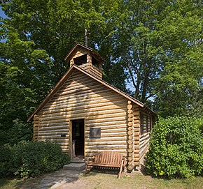
 eponymous, restored Old Mission hut |
||
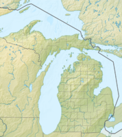
Old Mission Peninsula is the land arm that divides Grand Traverse Bay in Michigan , USA into the East Arm and West Arm . The main town is Mapleton. According to the 2000 census, 5265 people lived on the peninsula.
The highest point is Carpenter Hill in the south of the peninsula, at 256 meters above sea level, or 80 meters above the level of Lake Michigan .
The climate on this peninsula is ideal for growing wine and so there are a number of winemakers there . If you drive to the peninsula when the cherries are in bloom , you can admire 500,000 trees in full, white blossoms.
The Old Mission Light House is located at the tip of the island and is directly on the 45th parallel , i.e. exactly halfway from the equator to the North Pole . A historic Hessler log cabin can still be found there.
