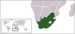
Oorlogskloof Nature Reserve
|
Oorlogskloof Nature Reserve
|
|
| location | South Africa |
| surface | 100 km² |
| Geographical location | 31 ° 27 ′ S , 19 ° 9 ′ E |
| Setup date | 1987 |
| administration | Northern Cape Nature Conservation |
The Oorlogskloof nature reserve is located 10 km south of Nieuwoudtville in the municipality of Hantam , Namakwa District , Northern Cape Province in South Africa , on the R27 road from Vanrhynsdorp to Calvinia .
Oorlog is the Afrikaans word for war, Kloof for a canyon. The nature reserve is a wilderness of gorges, caves, rivers, plateaus, with a rich flora from the areas of succulent Karoo , (mountain) fynbos and Afromontan forests . The average annual rainfall is 430 mm.
history
The land was bought in 1983 and designated as a wilderness area from 1983 to 1987, since then it has been a nature reserve. The size is around 10,000 hectares. The nature reserve now offers 146 km of hiking trails; hikes of one to seven days duration can be undertaken.
Flora and fauna
Protea and relatives: Leucadendron pubescens , Leucadendron salignum , Leucadendron sheilae , Leucospermum calligerum , Paranomus bracteolaris , Protea acuminata , Protea glabra , Protea laurifolia and Protea nitida .
63 species of ants, 200 species of bees / wasps, 44 species of reptiles and more than 200 species of birds are known to date. The large number of insects results, among other things, from the large number of plant species to be pollinated, some of which are highly specialized.

