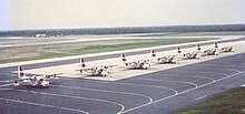
Otis Air National Guard Base
| Otis Air National Guard Base | ||
|---|---|---|
|
|
||
| Characteristics | ||
| ICAO code | KFMH | |
| IATA code | FMH | |
| Coordinates | ||
| Height above MSL | 40 m (131 ft ) | |
| Transport links | ||
| Distance from the city center | 3 miles east of Mashpee | |
| Street | US 6 | |
| Runways | ||
| 05/23 | 2438 m × 46 m asphalt concrete | |
| 14/32 | 2896 m × 46 m asphalt concrete | |
The Otis Air National Guard Base is a military airfield on the Cape Cod peninsula in the US state of Massachusetts .
history
The airfield opened in 1938 and was named in honor of the pilot Frank Otis , who was killed when his plane crashed in 1937.
During the Cold War , the airfield was one of the most important bases of the Air Force as part of the air defense against Soviet bombers from the Atlantic. After the Cold War, the base should be closed and the remaining units for 2005 Westfield-Barnes Regional Airport are displaced, the base has been switched to the Air National Guard assumed and thus serves as a reserve, in addition some units of are US Coast Guard continues stationed here. While the space shuttle was in use , Otis was a possible landing site in the event of an aborted take-off.
In the terrorist attacks on September 11, 2001 , two Otis F-15s took off, but flew over the Atlantic and so did not find the hijacked aircraft.

