Ottersbachtal
| Ottersbachtal | ||
|---|---|---|
|
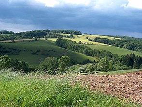
View over the Ottersbach valley |
||
| location | North Rhine-Westphalia , Germany | |
| Waters | Ottersbach | |
| Geographical location | 50 ° 47 '45 " N , 7 ° 28' 53" E | |
|
|
||
The Ottersbachtal is a valley in the municipality of Eitorf in the Rhine-Sieg district in North Rhine-Westphalia . The Ottersbach , which gives it its name, is a right tributary to the Sieg . The villages Rankenhohn , Kreisfeld , Ober -, Mittel - and Niederottersbach , Wilbertzhohn , Köttingen , Kehlenbach and Halft of the municipality of Eitorf are in the Ottersbachtal . The left bank of the stream belongs partly to the Windecker districts Altenherfen , Lüttershausen , Rieferath and Ringenstellen . These lie in the valley of the Rieferather Bach, which flows into the Ottersbach at Niederottersbach.
The mills operated by the Ottersbach in Kreisfeld, Niederottersbach and Halft are out of order today. In 1644 a document refers to an oil mill above the Wissbonnes that was lost in the Thirty Years' War in 1636 . Junker Adolf Quadt zu Isengarten, Jan Lambertz heirs from Wissbonnen and ultimately Henrich Khoengen zu Halft were named as their owners .
The villages in the Ottersbachtal are now connected to each other through their own club life, the highlight of which is the Ottersbach harvest thanksgiving procession, the only one in the Eitorf community. The football club SV Höhe , which also maintains youth teams, is supported by the villages of Herchener Höhe .
Individual evidence
- ↑ Wilhelm Hirtsiefer: Old mills in the former office of Blankenberg. In: Heimatblätter of the Siegkreis. 1950, issue 60.


