Oxolotán
| Oxolotán | ||
|---|---|---|
|
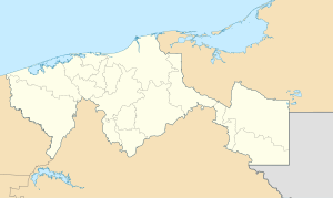
Coordinates: 17 ° 23 ′ N , 92 ° 45 ′ W Oxolotán on the map of Tabasco
|
||
| Basic data | ||
| Country | Mexico | |
| State | Tabasco | |
| Municipio | Tacotalpa | |
| Residents | 1886 (2010) | |
| Detailed data | ||
| height | 60 m | |
| Post Code | 86890 | |
| Oxolotán - Ex-Convento Santo Domingo de Guzmán | ||
Oxolotán is a village with almost 2,000 inhabitants in the municipality ( municipio ) Tacotalpa in the south of the Mexican state Tabasco .
location
Oxolotán lies in a loop of the Río Oxolotán at an altitude of approx. 60 m above sea level. d. About 95 km (driving distance) south of Villahermosa , the capital of the state, near the border with the mountainous and wooded state of Chiapas . The neighboring town of Tapijulapa is about 14 km northwest.
Economy and Infrastructure
The inhabitants of earlier centuries were self-sufficient in farming, raising turkeys and hunting. Crafts and retail trade developed in the 20th century. Tourism has been a source of income since the 1980s.
history
Oxolotán is in the field of Zoque - Maya . In the years 1529 to 1531 Francisco de Montejo succeeded in suppressing Indian revolts in the region and opened up a safe route from the southern Gulf coast to Chiapas. The Franciscan order settled here in 1532/3 , but finally the Dominican order founded a mission station in Oxolotán in 1572, which quickly gained in importance and became the core of a rapidly growing settlement. A few years later, Diego de Landa , the Bishop of Yucatán , made an inspection tour of the region. In the 18th century, Oxolotán was one of the largest towns in the region with around 3,000 inhabitants at that time, but diseases led to a population decline. The former mission church survived the demolition of the enclosure building, commissioned by the anti-church governor Tomás Garrido Canabal in 1926 .
Attractions
- The masonry of the single-nave church consists of round river stones ( bolas ) that are difficult to wall . The white-plastered nave has no vault, but only an open roof structure ; the apse , raised by three steps, closes flat. On the south side, a portal leads from the former enclosure into the church.
- The monastery buildings, which have been partially restored since 1979, now serve as the Museo de la Sierra .
- A nearby leisure park ( Kolem-Jaa ) offers numerous opportunities for sporting activities.
Web links
- Oxolotán, convent - photos + information (Spanish)
- Oxolotán - Info (INAH, Spanish)
- Río Oxolotán - Photo
- Río Oxolotán - photo with suspension bridge
- Oxolotán and surroundings - map with elevations .


