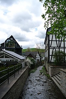
Palm tree (Brabecke)
| Palm tree | ||
|
Palm tree in Bödefeld |
||
| Data | ||
| location | North Rhine-Westphalia , Germany | |
| River system | Rhine | |
| Drain over | Brabecke → Valme → Ruhr → Rhine → North Sea | |
| muzzle | At Westernbödefeld coordinates: 51 ° 15 '36 " N , 8 ° 22' 40" E 51 ° 15 '36 " N , 8 ° 22' 40" E |
|
| Mouth height |
435 m above sea level NN
|
|
| length | 6.3 km | |
The palm is a 6.3 km long right tributary of the Brabecke in the North Rhine-Westphalian Hochsauerlandkreis , Germany .
In the upper reaches, the source rivers Rösternath and Kietelsiepen become palm trees around 1.3 kilometers south of Bödefeld . In the period from 2008 to 2011, the palm tree in Bödefeld was renatured for around one million euros . The river flows into the Brabecke south of Westernbödefeld .
Tributaries
The palm trees flow from the surrounding heights to include the Bermecke, Lermecke and Rehmecke.
Individual evidence
- ↑ WP: de: Palme now belongs to the village again from November 1, 2011, accessed on July 20, 2019
