Panchchuli
| Panchchuli II | ||
|---|---|---|
| height | 6904 m | |
| location | Uttarakhand ( India ) | |
| Mountains | Kumaon Himalayas | |
| Dominance | 44.83 km → Sunanda Devi | |
| Notch height | 1614 m | |
| Coordinates | 30 ° 12 '49 " N , 80 ° 25' 33" E | |
|
|
||
| First ascent | May 25, 1973 by an expedition of the Indian-Tibetan border police | |
|
Panchchuli II |
||
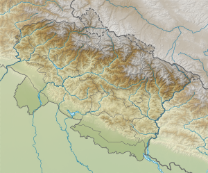
The Panchchuli (also Panch Chuli ) is a mountain range in the Himalayas in the Indian state of Uttarakhand .
The mountain range is located in the Pithoragarh district between the river valleys of Gori in the west and Darma in the east. The highest peak is the 6904 m high Panchchuli II . Its first ascent took place on May 25, 1973 by an expedition of the Indian-Tibetan border police led by Mahendra Singh over the southwest ridge. The mountain range of Nagalaphu and Chaudhara continues to the north . The Panchchuli V was also first climbed on October 17, 1972 by members of the Indo-Tibetan Border Police on the south ridge.
The peaks:
| Surname | Height in m | location |
|---|---|---|
| Panchchuli I | 6355 | 30 ° 12 ′ 12.7 " N , 80 ° 24 ′ 45" E |
| Panchchuli II | 6904 | 30 ° 12 '48.9 " N , 80 ° 25' 33.2" E |
| Panchchuli III | 6312 | 30 ° 12 '6.9 " N , 80 ° 26' 30.6" E |
| Panchchuli IV | 6334 | 30 ° 11 '44.3 " N , 80 ° 27' 16.4" E |
| Panchchuli V | 6437 | 30 ° 11 '17.4 " N , 80 ° 28' 8.8" E |
Web links
Commons : Panchchuli - collection of images, videos and audio files
- Panchchuli on Peakbagger.com (English)
- Panchchuli at Peakware (English)


