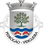
Pedrógão (Vidigueira)
| Pedrógão | ||||||
|---|---|---|---|---|---|---|
|
||||||
| Basic data | ||||||
| Region : | Alentejo | |||||
| Sub-region : | Baixo Alentejo | |||||
| District : | Be yes | |||||
| Concelho : | Vidigueira | |||||
| Coordinates : | 38 ° 7 ′ N , 7 ° 39 ′ W | |||||
| Residents: | 1151 (as of June 30, 2011) | |||||
| Surface: | 125.69 km² (as of January 1, 2010) | |||||
| Population density : | 9.2 inhabitants per km² | |||||
| politics | ||||||
| Address of the municipal administration: | Junta de Freguesia de Pedrógão Praça da Républica, n.º 15 7960 - 026 Pedrógão |
|||||
| Website: | www.cm-vidigueira.pt/municipio/pedrogao | |||||
Pedrógão is a municipality ( freguesia ) in the Alentejo in Portugal and is located in the district of Vidigueira . The community has a total area of 125.7 km² and 1151 inhabitants live there (as of June 30, 2011). The population density is 9.2 inhabitants per km².
history
The settlement of this area goes back to the Celts and then to the Romans . In Corte Serrão you can still see Celtic cult stones (Anta) today. The excavations of Monte do Peso, an early Roman residence, bear witness to the settlement during the Roman Empire.
The place has a church:
- Igreja de Santa Maria de Marmelar or Igreja de Santa Brígida
Individual evidence
- ↑ www.ine.pt - indicator resident population by place of residence and sex; Decennial in the database of the Instituto Nacional de Estatística
- ↑ Overview of code assignments from Freguesias on epp.eurostat.ec.europa.eu
Web links
- Map of the Freguesia Pedrógão (Vidigueira) at the Instituto Geográfico do Exército


