Penshurst, New South Wales
| Penshurst | |||||||||
|---|---|---|---|---|---|---|---|---|---|
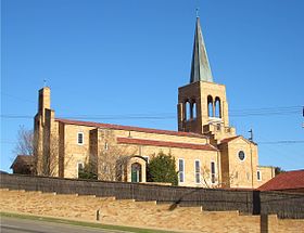
 St John's Church on King Georges Road |
|||||||||
|
|||||||||
|
|||||||||
|
|||||||||
|
|||||||||
|
|
|||||||||
Penshurst is a district of the metropolis Sydney in New South Wales , Australia . Penshurst is located 10 miles south of Sydney's central business district and is part of the St George area. The district has around 17,800 inhabitants (as of 2016).
Penshurst is divided into the two administrative areas of Hurstville City and Kogarah Council . The zip code is 2222.
Individual evidence
- ↑ a b Australian Bureau of Statistics : Penshurst (NSW) ( English ) In: 2016 Census QuickStats . June 27, 2017. Retrieved April 30, 2020.
